Magdalena Atlicpac night lights from space
Night Light of Magdalena Atlicpac (México) from space (Mexico) Src. Average luminocity for 10x10km area is 97.8471% and for 50x50km: 71.9786%.
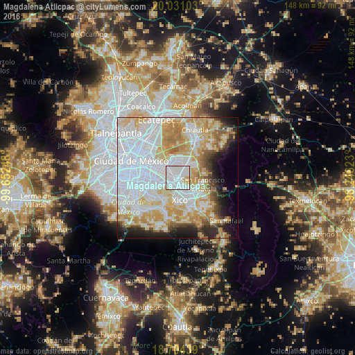
Analysis of Magdalena Atlicpac night lights 2016
Square area 10x10 km:
 58.68%
90-99
33.26%80-89
6.82%70-79
1.24%60-69
0%50-59
0%40-49
0%30-39
0%20-29
0%10-19
0%0-9
0%Square area 50x50 km:
31.71%90-99
12.24%80-89
12.09%70-79
10.32%60-69
6.21%50-59
3.02%40-49
3.41%30-39
2.7%20-29
4.87%10-19
6.32%0-9
7.12%Clear (daylight) street map image can be seen on geolist.org.
Map coordinates:
20° 1' 51.7" North, 99° 39' 8.9" West
19° 22' 8.6" North, 98° 56' 57.7" West
18° 42' 15.8" North, 98° 14' 46.4" West
Some cities around Magdalena Atlicpac sort by population:
• San Sebastián Chimalpa
1.5 km =0.9 mi,  336°
336°
• Lomas de San Sebastián
2.2 km =1.4 mi,  49°
49°
• Profesor Carlos Hank González
1.2 km =0.7 mi,  72°
72°
• El Pino
2 km =1.2 mi,  176°
176°
• San José las Palmas
1.7 km =1.1 mi,  97°
97°
• Tecamachalco
1.5 km =0.9 mi,  226°
226°
• Arenal
1.5 km =0.9 mi,  27°
27°
• Lomas de Altavista
1 km =0.6 mi,  150°
150°
3525424 (p: 26,429)
Sources (retrieved 2019-11-25):
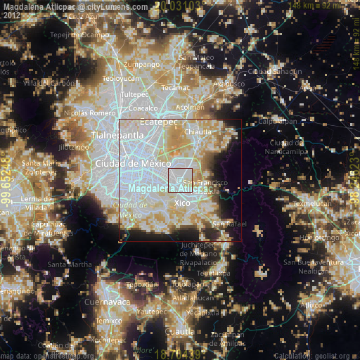
» Earth at Night: Flat Maps 2012, 2016