Petalcingo night lights from space
Night Light of Petalcingo (Chiapas) from space (Mexico) Src. Average luminocity for 10x10km area is 1.4566% and for 50x50km: 1.6054%.
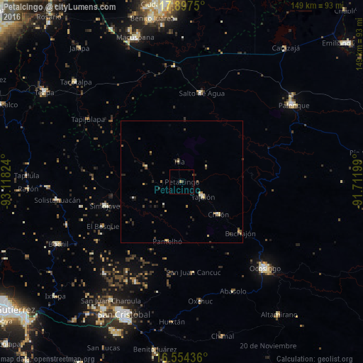
Analysis of Petalcingo night lights 2016
Square area 10x10 km:
 0%
0%90-99
0%80-89
0%70-79
0%60-69
0.83%50-59
0.21%40-49
0.41%30-39
0.62%20-29
0%10-19
0.62%0-9
97.31%Square area 50x50 km:
0.01%90-99
0.2%80-89
0.26%70-79
0.19%60-69
0.28%50-59
0.16%40-49
0.3%30-39
0.4%20-29
0.6%10-19
0.58%0-9
97.02%Clear (daylight) street map image can be seen on geolist.org.
Map coordinates:
17° 53' 51" North, 93° 7' 5.7" West
17° 13' 37.7" North, 92° 24' 54.4" West
16° 33' 15.7" North, 91° 42' 43.2" West
Some cities around Petalcingo sort by population:
• Yajalón
10.6 km =6.6 mi,  124°
124°
• Simojovel de Allende
33.2 km =20.6 mi,  253°
253°
• Chilón
20.3 km =12.6 mi,  131°
131°
• Tila
8.3 km =5.2 mi,  350°
350°
• Pantelhó
25.4 km =15.8 mi,  193°
193°
• Chilón
0.7 km =0.4 mi, 346°
• Salto de Agua
37.3 km =23.2 mi,  12°
12°
• Bachajón
31.7 km =19.7 mi, 131°
3521610 (p: 6,775)
Sources (retrieved 2019-11-25):
» Earth at Night: Flat Maps 2012, 2016