Apetatitlán Antonio Carbajal night lights from space
Night Light of Apetatitlán Antonio Carbajal (Tlaxcala) from space (Mexico) Src. Average luminocity for 10x10km area is 81.1632% and for 50x50km: 37.8401%.
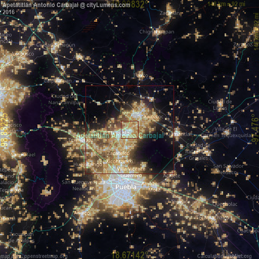
Analysis of Apetatitlán Antonio Carbajal night lights 2016
Square area 10x10 km:
 11.98%
90-99
13.02%80-89
29.34%70-79
25.62%60-69
13.43%50-59
5.79%40-49
0.83%30-39
0%20-29
0%10-19
0%0-9
0%Square area 50x50 km:
2.17%90-99
3.89%80-89
11.66%70-79
8.26%60-69
6.77%50-59
5.94%40-49
7.1%30-39
3.85%20-29
4.96%10-19
10.82%0-9
34.58%Clear (daylight) street map image can be seen on geolist.org.
Map coordinates:
19° 59' 54" North, 98° 52' 56.1" West
19° 20' 10.4" North, 98° 10' 44.8" West
18° 40' 17.1" North, 97° 28' 33.6" West
Some cities around Apetatitlán Antonio Carbajal sort by population:
• Tlaxcala
2.9 km =1.8 mi,  228°
228°
• Santa Ana Chiautempan
3.4 km =2.1 mi,  195°
195°
• Contla
1.5 km =0.9 mi,  119°
119°
• La Magdalena Tlaltelulco
6.2 km =3.9 mi, 196°
• Amaxac de Guerrero
1.5 km =0.9 mi,  37°
37°
• San Esteban Tizatlán
3.6 km =2.2 mi,  275°
275°
• San Miguel Contla
5.6 km =3.5 mi,  60°
60°
• Santa María Ixtulco
3.3 km =2.1 mi,  248°
248°
3518140 (p: 7,026)
Sources (retrieved 2019-11-25):
» Earth at Night: Flat Maps 2012, 2016