Anáhuac night lights from space
Night Light of Anáhuac (Nuevo León) from space (Mexico) Src. Average luminocity for 10x10km area is 10.8523% and for 50x50km: 0.4488%.
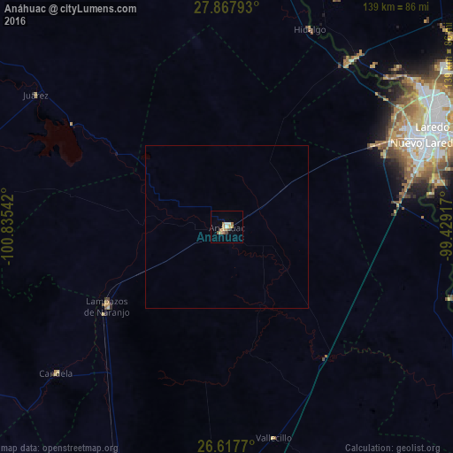
Analysis of Anáhuac night lights 2016
Square area 10x10 km:
 0.95%
0.95%90-99
1.33%80-89
0.76%70-79
3.22%60-69
3.6%50-59
0.76%40-49
1.14%30-39
0.38%20-29
0%10-19
0%0-9
87.88%Square area 50x50 km:
0.04%90-99
0.05%80-89
0.03%70-79
0.13%60-69
0.14%50-59
0.03%40-49
0.05%30-39
0.02%20-29
0%10-19
0%0-9
99.51%Clear (daylight) street map image can be seen on geolist.org.
Map coordinates:
27° 52' 4.5" North, 100° 50' 7.5" West
27° 14' 40.5" North, 100° 7' 56.2" West
26° 37' 3.7" North, 99° 25' 45" West
Some cities around Anáhuac sort by population:
• Nuevo Laredo
66.1 km =41.1 mi,  67°
67°
• Laredo, US
68.2 km =42.4 mi,  64°
64°
• Sabinas
118.5 km =73.6 mi,  304°
304°
• Ciudad Sabinas Hidalgo
82.5 km =51.3 mi,  183°
183°
• Minas de Barroterán
122.1 km =75.9 mi,  291°
291°
• El Campanario y Oradel
56.6 km =35.2 mi, 63°
• Zapata, US
93.1 km =57.8 mi,  113°
113°
• Lampazos de Naranjo
44.2 km =27.5 mi,  236°
236°
4013726 (p: 16,628)
Sources (retrieved 2019-11-25):
» Earth at Night: Flat Maps 2012, 2016