Zapata night lights from space
Night Light of Zapata (Texas) from space (United States) Src. Average luminocity for 10x10km area is 25.5734% and for 50x50km: 1.4167%.
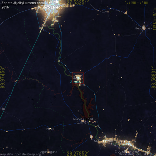
Analysis of Zapata night lights 2016
Square area 10x10 km:
 1.19%
1.19%90-99
1.19%80-89
7.54%70-79
4.96%60-69
4.96%50-59
3.97%40-49
0%30-39
4.17%20-29
3.37%10-19
22.02%0-9
46.63%Square area 50x50 km:
0.05%90-99
0.05%80-89
0.35%70-79
0.24%60-69
0.25%50-59
0.24%40-49
0.18%30-39
0.22%20-29
0.16%10-19
0.88%0-9
97.39%Clear (daylight) street map image can be seen on geolist.org.
Map coordinates:
27° 31' 57" North, 99° 58' 28.4" West
26° 54' 26.1" North, 99° 16' 17.1" West
26° 16' 42.7" North, 98° 34' 5.9" West
Some cities around Zapata sort by population:
• Nuevo Laredo, MX
67.7 km =42.1 mi,  339°
339°
• Laredo
70.6 km =43.9 mi, 340°
• Ciudad Miguel Alemán, MX
61.4 km =38.2 mi,  156°
156°
• Rio Grande City
73.8 km =45.9 mi,  142°
142°
• Roma
61.3 km =38.1 mi, 155°
• Roma-Los Saenz
61.3 km =38.1 mi, 155°
• Ciudad Camargo, MX
79 km =49.1 mi,  146°
146°
• El Campanario y Oradel, MX
71.7 km =44.6 mi,  331°
331°
4743575 (p: 5,089)
Sources (retrieved 2019-11-25):
» Earth at Night: Flat Maps 2012, 2016