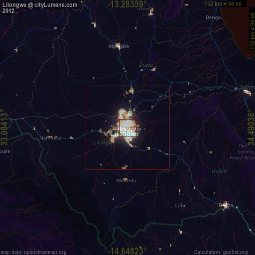
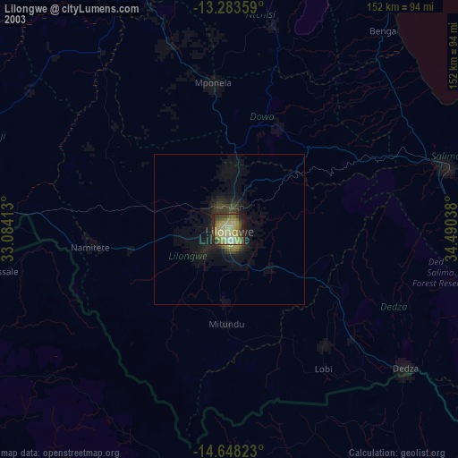
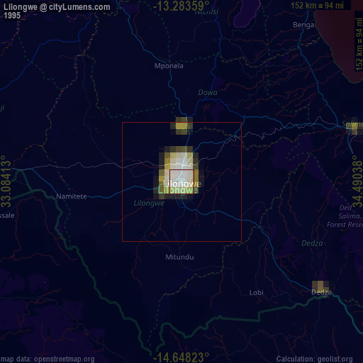
Lilongwe night lights from space
Night Light of Lilongwe (Central Region) from space (Malawi) Src. Average luminocity for 10x10km area is 85.9938% and for 50x50km: 9.2431%.
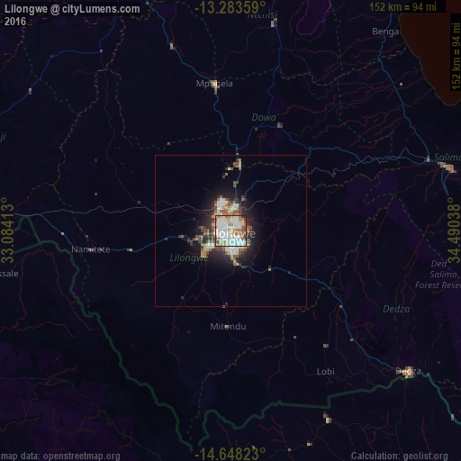
Analysis of Lilongwe night lights 2016
Square area 10x10 km:
 31.61%
90-99
30.58%80-89
6.61%70-79
8.26%60-69
11.36%50-59
7.23%40-49
2.48%30-39
0.83%20-29
1.03%10-19
0%0-9
0%Square area 50x50 km:
1.87%90-99
1.91%80-89
0.51%70-79
0.83%60-69
1.13%50-59
1.81%40-49
1.14%30-39
1.36%20-29
2.34%10-19
5.15%0-9
81.95%Clear (daylight) street map image can be seen on geolist.org.
Map coordinates:
13° 17' 0.9" South, 33° 5' 2.9" East
13° 58' 0.9" South, 33° 47' 14.1" East
14° 38' 53.6" South, 34° 29' 25.4" East
Some cities around Lilongwe sort by population:
• Kasungu
108.9 km =67.7 mi,  342°
342°
• Salima
75.4 km =46.9 mi,  74°
74°
• Mchinji
99.7 km =62 mi,  280°
280°
• Dedza
74.5 km =46.3 mi,  127°
127°
• Monkey Bay
122.5 km =76.1 mi,  96°
96°
• Mponela
48.6 km =30.2 mi,  353°
353°
• Ntchisi
50.7 km =31.5 mi,  15°
15°
• Dowa
38.4 km =23.9 mi,  25°
25°
927967 (p: 646,750)
Sources (retrieved 2019-11-25):
» NASA, Earths city lights 1995
» NASA city lights 2003
» Earth at Night: Flat Maps 2012, 2016