Le Robert night lights from space
Night Light of Le Robert (Martinique) from space (Martinique) Src. Average luminocity for 10x10km area is 50.7913% and for 50x50km: 19.8342%.
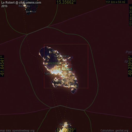
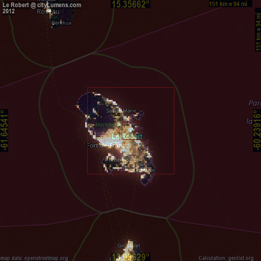
Analysis of Le Robert night lights 2016
Square area 10x10 km:
 1.65%
1.65%90-99
3.51%80-89
10.12%70-79
17.56%60-69
9.92%50-59
8.06%40-49
10.54%30-39
9.3%20-29
12.4%10-19
14.67%0-9
2.27%Square area 50x50 km:
1.57%90-99
1.82%80-89
4.09%70-79
3.85%60-69
2.41%50-59
2.68%40-49
3.88%30-39
4.95%20-29
5.66%10-19
10.2%0-9
58.89%Clear (daylight) street map image can be seen on geolist.org.
Map coordinates:
15° 21' 23.8" North, 61° 38' 43.5" West
14° 40' 39" North, 60° 56' 32.2" West
13° 59' 46.6" North, 60° 14' 21" West
Some cities around Le Robert sort by population:
• Le Lamentin
9.4 km =5.8 mi,  220°
220°
• Sainte-Marie
13 km =8.1 mi,  335°
335°
• Le François
8.1 km =5 mi,  148°
148°
• Ducos
11.9 km =7.4 mi,  196°
196°
• Saint-Joseph
10.4 km =6.5 mi,  266°
266°
• La Trinité
7.1 km =4.4 mi, 341°
• Le Gros-Morne
6.7 km =4.2 mi,  291°
291°
• Saint-Esprit
14.2 km =8.8 mi,  176°
176°
3570412 (p: 23,814)
Sources (retrieved 2019-11-25):
» Earth at Night: Flat Maps 2012, 2016