Le Lamentin night lights from space
Night Light of Le Lamentin (Martinique) from space (Martinique) Src. Average luminocity for 10x10km area is 76.4675% and for 50x50km: 20.3826%.
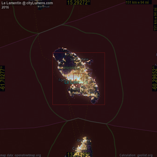
Analysis of Le Lamentin night lights 2016
Square area 10x10 km:
 13.64%
90-99
14.07%80-89
24.46%70-79
17.1%60-69
10.61%50-59
6.28%40-49
4.33%30-39
8.23%20-29
1.3%10-19
0%0-9
0%Square area 50x50 km:
1.6%90-99
1.87%80-89
4.14%70-79
3.82%60-69
2.41%50-59
2.75%40-49
3.92%30-39
5.13%20-29
5.73%10-19
11.04%0-9
57.59%Clear (daylight) street map image can be seen on geolist.org.
Map coordinates:
15° 17' 33.8" North, 61° 42' 10" West
14° 36' 48.3" North, 60° 59' 58.7" West
13° 55' 55.2" North, 60° 17' 47.5" West
Some cities around Le Lamentin sort by population:
• Fort-de-France
8.1 km =5 mi,  262°
262°
• Le Robert
9.4 km =5.8 mi,  40°
40°
• Le François
10.4 km =6.5 mi,  88°
88°
• Ducos
5 km =3.1 mi,  147°
147°
• Saint-Joseph
7.7 km =4.8 mi,  326°
326°
• Le Gros-Morne
9.6 km =6 mi,  359°
359°
• Saint-Esprit
10 km =6.2 mi,  134°
134°
• Les Trois-Îlets
9 km =5.6 mi,  203°
203°
3570428 (p: 39,229)
Sources (retrieved 2019-11-25):
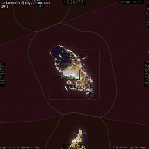
» Earth at Night: Flat Maps 2012, 2016