Le François night lights from space
Night Light of Le François (Martinique) from space (Martinique) Src. Average luminocity for 10x10km area is 45.132% and for 50x50km: 19.0083%.
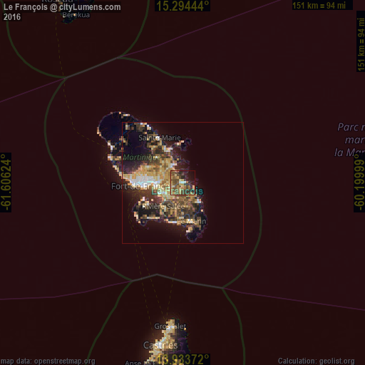
Analysis of Le François night lights 2016
Square area 10x10 km:
 1.08%
1.08%90-99
1.52%80-89
10.82%70-79
6.06%60-69
9.31%50-59
11.26%40-49
17.1%30-39
11.69%20-29
8.87%10-19
15.8%0-9
6.49%Square area 50x50 km:
1.53%90-99
1.78%80-89
3.85%70-79
3.6%60-69
2.33%50-59
2.63%40-49
3.78%30-39
4.73%20-29
5.39%10-19
9.77%0-9
60.62%Clear (daylight) street map image can be seen on geolist.org.
Map coordinates:
15° 17' 40" North, 61° 36' 22.5" West
14° 36' 54.5" North, 60° 54' 11.2" West
13° 56' 1.4" North, 60° 11' 60" West
Some cities around Le François sort by population:
• Le Lamentin
10.4 km =6.5 mi,  268°
268°
• Le Robert
8.1 km =5 mi,  328°
328°
• Ducos
8.9 km =5.5 mi,  240°
240°
• La Trinité
15.1 km =9.4 mi, 334°
• Rivière-Pilote
14.2 km =8.8 mi,  179°
179°
• Le Gros-Morne
14.1 km =8.8 mi,  312°
312°
• Saint-Esprit
7.9 km =4.9 mi,  204°
204°
• Le Vauclin
10.4 km =6.5 mi,  138°
138°
3570429 (p: 19,682)
Sources (retrieved 2019-11-25):
» Earth at Night: Flat Maps 2012, 2016