Sainte-Marie night lights from space
Night Light of Sainte-Marie (Martinique) from space (Martinique) Src. Average luminocity for 10x10km area is 28.5021% and for 50x50km: 14.9195%.
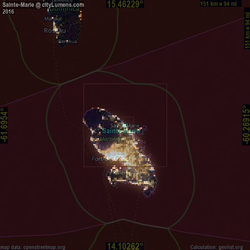
Analysis of Sainte-Marie night lights 2016
Square area 10x10 km:
 2.89%
2.89%90-99
2.89%80-89
5.17%70-79
2.27%60-69
5.17%50-59
2.48%40-49
4.75%30-39
8.06%20-29
5.99%10-19
31.61%0-9
28.72%Square area 50x50 km:
1.38%90-99
1.62%80-89
3.22%70-79
3.03%60-69
1.77%50-59
1.68%40-49
2.27%30-39
3.27%20-29
3.68%10-19
7.38%0-9
70.69%Clear (daylight) street map image can be seen on geolist.org.
Map coordinates:
15° 27' 44.2" North, 61° 41' 43.4" West
14° 47' 0.7" North, 60° 59' 32.2" West
14° 6' 9.4" North, 60° 17' 20.9" West
Some cities around Sainte-Marie sort by population:
• Fort-de-France
21.9 km =13.6 mi,  203°
203°
• Le Lamentin
18.9 km =11.7 mi,  182°
182°
• Le Robert
13 km =8.1 mi,  155°
155°
• Le François
21 km =13 mi,  152°
152°
• La Trinité
5.9 km =3.7 mi, 148°
• Le Gros-Morne
9.3 km =5.8 mi,  185°
185°
• Le Lorrain
8.7 km =5.4 mi,  308°
308°
• Le Morne-Rouge
15.4 km =9.6 mi,  266°
266°
3569926 (p: 20,380)
Sources (retrieved 2019-11-25):
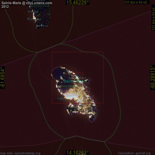
» Earth at Night: Flat Maps 2012, 2016