Saint-Esprit night lights from space
Night Light of Saint-Esprit (Martinique) from space (Martinique) Src. Average luminocity for 10x10km area is 58.4069% and for 50x50km: 18.6882%.
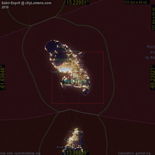
Analysis of Saint-Esprit night lights 2016
Square area 10x10 km:
 1.08%
1.08%90-99
1.95%80-89
16.88%70-79
11.04%60-69
10.82%50-59
18.18%40-49
25.32%30-39
8.66%20-29
6.06%10-19
0%0-9
0%Square area 50x50 km:
1.47%90-99
1.68%80-89
3.94%70-79
3.66%60-69
2.33%50-59
2.53%40-49
3.65%30-39
4.52%20-29
5.43%10-19
9.9%0-9
60.89%Clear (daylight) street map image can be seen on geolist.org.
Map coordinates:
15° 13' 46.2" North, 61° 38' 11.3" West
14° 33' 0" North, 60° 55' 60" West
13° 52' 6.2" North, 60° 13' 48.8" West
Some cities around Saint-Esprit sort by population:
• Le Lamentin
10 km =6.2 mi,  314°
314°
• Le Robert
14.2 km =8.8 mi,  356°
356°
• Le François
7.9 km =4.9 mi,  24°
24°
• Ducos
5.3 km =3.3 mi,  302°
302°
• Rivière-Pilote
7.7 km =4.8 mi,  154°
154°
• Le Marin
11.1 km =6.9 mi,  141°
141°
• Le Vauclin
10.2 km =6.3 mi,  92°
92°
• Les Trois-Îlets
10.9 km =6.8 mi,  263°
263°
3570410 (p: 8,508)
Sources (retrieved 2019-11-25):
» Earth at Night: Flat Maps 2012, 2016