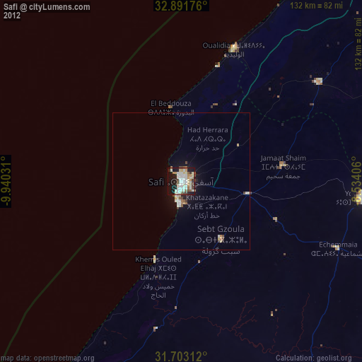
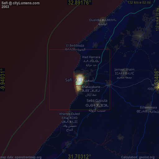
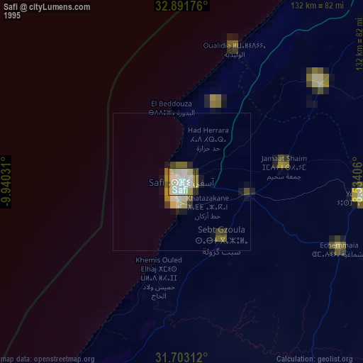
Safi night lights from space
Night Light of Safi (Marrakesh-Safi) from space (Morocco) Src. Average luminocity for 10x10km area is 50.3755% and for 50x50km: 3.6727%.
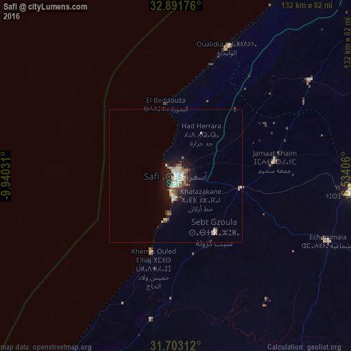
Analysis of Safi night lights 2016
Square area 10x10 km:
 9.52%
9.52%90-99
13.92%80-89
5.68%70-79
4.58%60-69
8.61%50-59
4.21%40-49
6.04%30-39
4.4%20-29
15.02%10-19
24.54%0-9
3.48%Square area 50x50 km:
0.52%90-99
0.66%80-89
0.5%70-79
0.28%60-69
0.55%50-59
0.37%40-49
0.48%30-39
0.42%20-29
0.88%10-19
2.99%0-9
92.35%Clear (daylight) street map image can be seen on geolist.org.
Map coordinates:
32° 53' 30.3" North, 9° 56' 25.1" West
32° 17' 57.8" North, 9° 14' 13.8" West
31° 42' 11.2" North, 8° 32' 2.6" West
Some cities around Safi sort by population:
• Marrakesh
138.2 km =85.9 mi,  122°
122°
• El Jadid
126.4 km =78.5 mi,  32°
32°
• Settat
170.6 km =106 mi,  62°
62°
• Essaouira
100.9 km =62.7 mi,  209°
209°
• Youssoufia
66.8 km =41.5 mi,  95°
95°
• Sidi Bennour
85.5 km =53.1 mi, 62°
• Azemmour
138.2 km =85.9 mi,  37°
37°
• Oualidia
52 km =32.3 mi,  21°
21°
2537881 (p: 288,163)
Sources (retrieved 2019-11-25):
» NASA, Earths city lights 1995
» NASA city lights 2003
» Earth at Night: Flat Maps 2012, 2016