Errachidia night lights from space
Night Light of Errachidia (Drâa-Tafilalet) from space (Morocco) Src. Average luminocity for 10x10km area is 38.3934% and for 50x50km: 1.9226%.
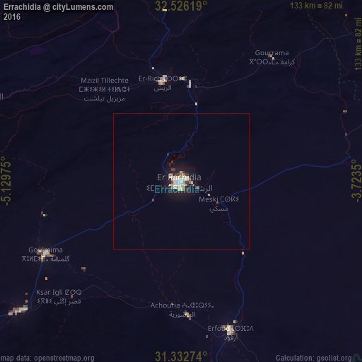
Analysis of Errachidia night lights 2016
Square area 10x10 km:
 6.29%
6.29%90-99
6.99%80-89
7.69%70-79
4.72%60-69
3.67%50-59
3.5%40-49
3.5%30-39
4.9%20-29
3.5%10-19
41.96%0-9
13.29%Square area 50x50 km:
0.26%90-99
0.29%80-89
0.32%70-79
0.22%60-69
0.15%50-59
0.17%40-49
0.18%30-39
0.26%20-29
0.23%10-19
2.15%0-9
95.77%Clear (daylight) street map image can be seen on geolist.org.
Map coordinates:
32° 31' 34.3" North, 5° 7' 47.1" West
31° 55' 53" North, 4° 25' 35.9" West
31° 19' 57.9" North, 3° 43' 24.6" West
Some cities around Errachidia sort by population:
• Khenifra
160.9 km =100 mi,  313°
313°
• Azrou
182.9 km =113.6 mi,  336°
336°
• Midelt
89 km =55.3 mi, 340°
• Tinghir
114.4 km =71.1 mi,  246°
246°
• Arfoud
58.1 km =36.1 mi,  161°
161°
• Reçani
73.7 km =45.8 mi,  168°
168°
• Kelaat Mgouna
178.7 km =111 mi,  244°
244°
• Aïn Leuh
173.5 km =107.8 mi,  330°
330°
7280528 (p: 92,374)
Sources (retrieved 2019-11-25):
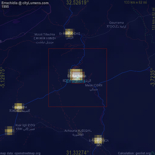
» NASA, Earths city lights 1995
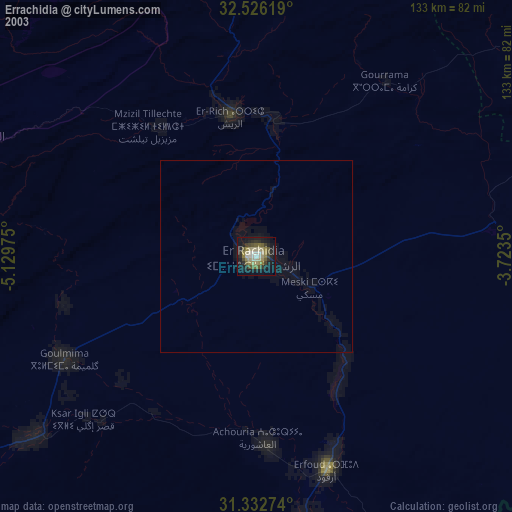
» NASA city lights 2003
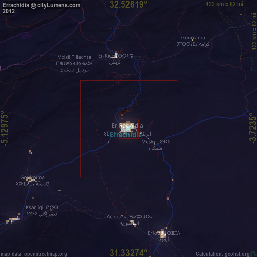
» Earth at Night: Flat Maps 2012, 2016