Aïn Leuh night lights from space
Night Light of Aïn Leuh (Fès-Meknès) from space (Morocco) Src. Average luminocity for 10x10km area is 2.264% and for 50x50km: 1.5768%.
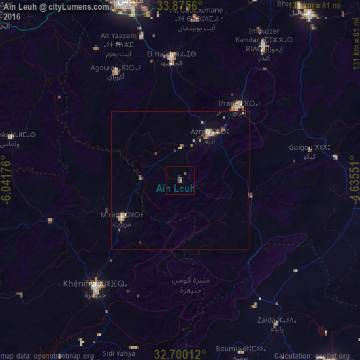
Analysis of Aïn Leuh night lights 2016
Square area 10x10 km:
 0%
0%90-99
0%80-89
0%70-79
0%60-69
0.7%50-59
1.4%40-49
1.05%30-39
0.35%20-29
0.7%10-19
0%0-9
95.8%Square area 50x50 km:
0.06%90-99
0.09%80-89
0.24%70-79
0.4%60-69
0.16%50-59
0.19%40-49
0.26%30-39
0.35%20-29
0.26%10-19
0.26%0-9
97.75%Clear (daylight) street map image can be seen on geolist.org.
Map coordinates:
33° 52' 32.2" North, 6° 2' 30.3" West
33° 17' 23.4" North, 5° 20' 19.1" West
32° 42' 0.4" North, 4° 38' 7.8" West
Some cities around Aïn Leuh sort by population:
• Meknès
69.8 km =43.4 mi,  343°
343°
• Khenifra
49.6 km =30.8 mi,  217°
217°
• Ifrane
33.8 km =21 mi,  38°
38°
• Sefrou
76.6 km =47.6 mi, 38°
• Azrou
19.4 km =12.1 mi,  34°
34°
• Midelt
87.1 km =54.1 mi,  140°
140°
• El Hajeb
44.4 km =27.6 mi,  356°
356°
• Oulmes
63.4 km =39.4 mi,  283°
283°
2560813 (p: 5,278)
Sources (retrieved 2019-11-25):
» Earth at Night: Flat Maps 2012, 2016