Azrou night lights from space
Night Light of Azrou (Fès-Meknès) from space (Morocco) Src. Average luminocity for 10x10km area is 16.6993% and for 50x50km: 1.8112%.
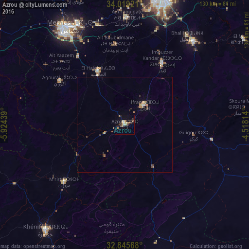
Analysis of Azrou night lights 2016
Square area 10x10 km:
100  0.87%
0.87%
90-99 1.22%
80-89 2.97%
70-79 4.72%
60-69 0.7%
50-59 1.57%
40-49 1.57%
30-39 4.2%
20-29 3.15%
10-19 5.24%
0-9 73.78%
0.87%90-99
1.22%80-89
2.97%70-79
4.72%60-69
0.7%50-59
1.57%40-49
1.57%30-39
4.2%20-29
3.15%10-19
5.24%0-9
73.78%Square area 50x50 km:
100 0.06%
90-99 0.15%
80-89 0.26%
70-79 0.36%
60-69 0.32%
50-59 0.14%
40-49 0.29%
30-39 0.44%
20-29 0.27%
10-19 0.27%
0-9 97.44%
0.06%90-99
0.15%80-89
0.26%70-79
0.36%60-69
0.32%50-59
0.14%40-49
0.29%30-39
0.44%20-29
0.27%10-19
0.27%0-9
97.44%Clear (daylight) street map image can be seen on geolist.org.
Map coordinates:
34° 1' 9.2" North, 5° 55' 27.8" West
33° 26' 3.9" North, 5° 13' 16.5" West
32° 50' 44.4" North, 4° 31' 5.3" West
Some cities around Azrou sort by population:
• Fès
69.6 km =43.2 mi,  17°
17°
• Meknès
59.3 km =36.8 mi,  329°
329°
• Khenifra
69 km =42.9 mi,  216°
216°
• Ifrane
14.5 km =9 mi,  45°
45°
• Sefrou
57.3 km =35.6 mi,  39°
39°
• El Hajeb
31.4 km =19.5 mi, 333°
• Oulmes
72.4 km =45 mi,  269°
269°
• Aïn Leuh
19.4 km =12.1 mi,  214°
214°
2556464 (p: 48,249)
Sources (retrieved 2019-11-25):
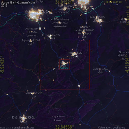
» Earth at Night: Flat Maps 2012, 2016