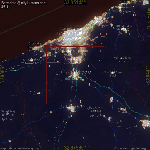
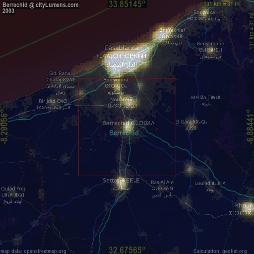
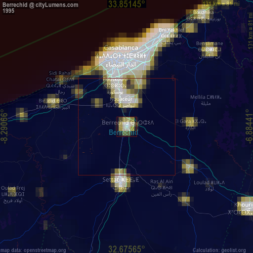
Berrechid night lights from space
Night Light of Berrechid (Casablanca-Settat) from space (Morocco) Src. Average luminocity for 10x10km area is 41.1906% and for 50x50km: 12.6024%.
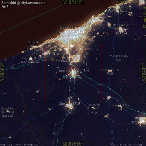
Analysis of Berrechid night lights 2016
Square area 10x10 km:
 5.42%
5.42%90-99
4.55%80-89
8.04%70-79
3.5%60-69
6.64%50-59
5.42%40-49
7.34%30-39
9.97%20-29
12.59%10-19
33.92%0-9
2.62%Square area 50x50 km:
0.79%90-99
0.99%80-89
1.52%70-79
1.82%60-69
2.69%50-59
1.87%40-49
3.48%30-39
3.63%20-29
4.34%10-19
7.41%0-9
71.45%Clear (daylight) street map image can be seen on geolist.org.
Map coordinates:
33° 51' 5.2" North, 8° 17' 26.4" West
33° 15' 55.9" North, 7° 35' 15.1" West
32° 40' 32.3" North, 6° 53' 3.9" West
Some cities around Berrechid sort by population:
• Casablanca
36 km =22.4 mi,  356°
356°
• Mohammedia
50.5 km =31.4 mi,  22°
22°
• Khouribga
76.5 km =47.5 mi,  123°
123°
• Settat
29.5 km =18.3 mi,  185°
185°
• Skhirate
83.2 km =51.7 mi,  38°
38°
• Azemmour
70.2 km =43.6 mi,  272°
272°
• Bouznika
70.5 km =43.8 mi,  34°
34°
• Zawyat an Nwaçer
13 km =8.1 mi,  346°
346°
2556272 (p: 93,954)
Sources (retrieved 2019-11-25):
» NASA, Earths city lights 1995
» NASA city lights 2003
» Earth at Night: Flat Maps 2012, 2016