Mohammedia night lights from space
Night Light of Mohammedia (Casablanca-Settat) from space (Morocco) Src. Average luminocity for 10x10km area is 66.8114% and for 50x50km: 21.4044%.
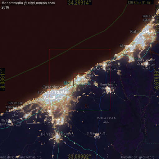
Analysis of Mohammedia night lights 2016
Square area 10x10 km:
 14.47%
90-99
15.38%80-89
8.61%70-79
11.17%60-69
17.03%50-59
2.93%40-49
8.42%30-39
5.86%20-29
11.72%10-19
4.4%0-9
0%Square area 50x50 km:
5.35%90-99
2.78%80-89
2.16%70-79
3.65%60-69
4.31%50-59
2.01%40-49
2.16%30-39
2.7%20-29
4.28%10-19
7.89%0-9
62.71%Clear (daylight) street map image can be seen on geolist.org.
Map coordinates:
34° 16' 8.9" North, 8° 5' 10" West
33° 41' 9.9" North, 7° 22' 58.7" West
33° 5' 56.5" North, 6° 40' 47.5" West
Some cities around Mohammedia sort by population:
• Casablanca
23.8 km =14.8 mi,  242°
242°
• Rabat
62.5 km =38.8 mi,  54°
54°
• Sale
67.7 km =42.1 mi, 52°
• Temara
51.6 km =32.1 mi,  58°
58°
• Berrechid
50.5 km =31.4 mi,  202°
202°
• Skhirate
37.4 km =23.2 mi, 60°
• Bouznika
23.6 km =14.7 mi, 60°
• Zawyat an Nwaçer
40.5 km =25.2 mi,  212°
212°
2542051 (p: 187,708)
Sources (retrieved 2019-11-25):
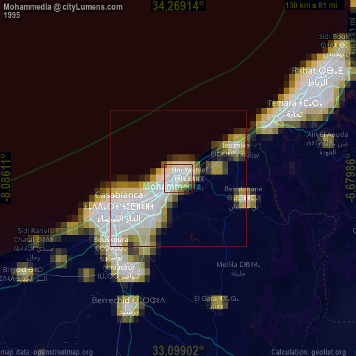
» NASA, Earths city lights 1995
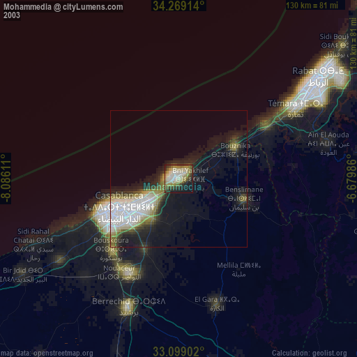
» NASA city lights 2003
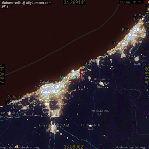
» Earth at Night: Flat Maps 2012, 2016