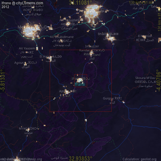
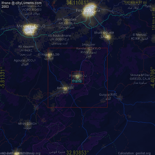
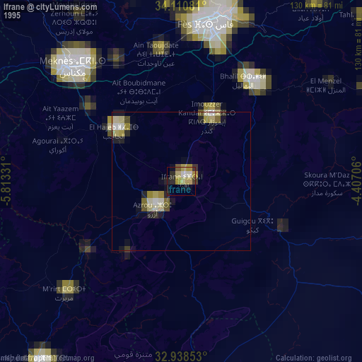
Ifrane night lights from space
Night Light of Ifrane (Fès-Meknès) from space (Morocco) Src. Average luminocity for 10x10km area is 14.8114% and for 50x50km: 2.3978%.
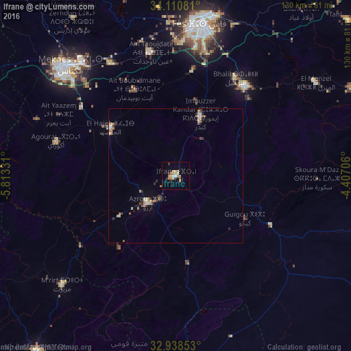
Analysis of Ifrane night lights 2016
Square area 10x10 km:
 0.73%
0.73%90-99
2.38%80-89
2.2%70-79
2.75%60-69
4.4%50-59
0%40-49
0.73%30-39
2.93%20-29
1.1%10-19
1.1%0-9
81.68%Square area 50x50 km:
0.12%90-99
0.35%80-89
0.3%70-79
0.46%60-69
0.52%50-59
0.14%40-49
0.24%30-39
0.43%20-29
0.33%10-19
0.27%0-9
96.84%Clear (daylight) street map image can be seen on geolist.org.
Map coordinates:
34° 6' 38.9" North, 5° 48' 47.9" West
33° 31' 36" North, 5° 6' 36.7" West
32° 56' 18.7" North, 4° 24' 25.4" West
Some cities around Ifrane sort by population:
• Fès
57.2 km =35.5 mi,  10°
10°
• Meknès
57.4 km =35.7 mi,  315°
315°
• Fès al Bali
62.1 km =38.6 mi, 13°
• Khenifra
83.4 km =51.8 mi,  217°
217°
• Sefrou
42.8 km =26.6 mi,  37°
37°
• Azrou
14.5 km =9 mi,  225°
225°
• El Hajeb
30.1 km =18.7 mi,  306°
306°
• Aïn Leuh
33.8 km =21 mi, 218°
2546917 (p: 73,782)
Sources (retrieved 2019-11-25):
» NASA, Earths city lights 1995
» NASA city lights 2003
» Earth at Night: Flat Maps 2012, 2016