Fès night lights from space
Night Light of Fès (Fès-Meknès) from space (Morocco) Src. Average luminocity for 10x10km area is 88.3024% and for 50x50km: 11.3956%.
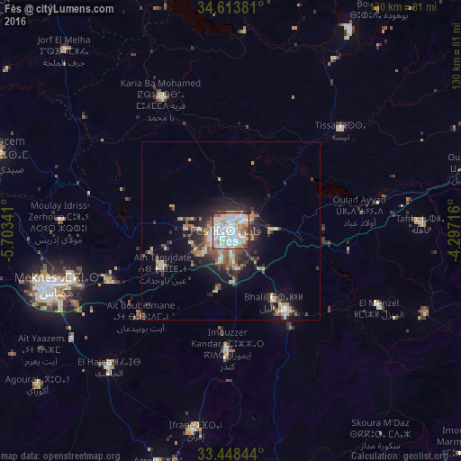
Analysis of Fès night lights 2016
Square area 10x10 km:
 34.79%
90-99
32.17%80-89
9.09%70-79
6.29%60-69
6.82%50-59
5.42%40-49
4.37%30-39
0.7%20-29
0.35%10-19
0%0-9
0%Square area 50x50 km:
1.82%90-99
2.01%80-89
1.57%70-79
1.23%60-69
1.38%50-59
1.14%40-49
1.49%30-39
2.07%20-29
3.09%10-19
6.11%0-9
78.1%Clear (daylight) street map image can be seen on geolist.org.
Map coordinates:
34° 36' 49.7" North, 5° 42' 12.3" West
34° 1' 59.3" North, 5° 0' 1" West
33° 26' 54.4" North, 4° 17' 49.8" West
Some cities around Fès sort by population:
• Meknès
52.8 km =32.8 mi,  252°
252°
• Fès al Bali
5.9 km =3.7 mi,  45°
45°
• Sidi Qacem
68.4 km =42.5 mi,  287°
287°
• Ifrane
57.2 km =35.5 mi,  190°
190°
• Sefrou
27.4 km =17 mi,  144°
144°
• Taounate
65 km =40.4 mi,  30°
30°
• El Hajeb
51.4 km =31.9 mi,  221°
221°
• Tahla
53.3 km =33.1 mi,  88°
88°
2548885 (p: 964,891)
Sources (retrieved 2019-11-25):
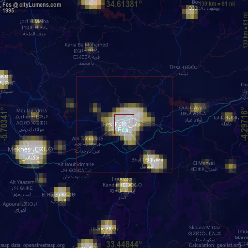
» NASA, Earths city lights 1995
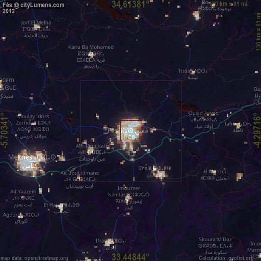
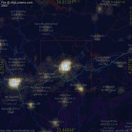
» NASA city lights 2003
» Earth at Night: Flat Maps 2012, 2016