Sirte night lights from space
Night Light of Sirte (Surt) from space (Libya) Src. Average luminocity for 10x10km area is 36.2527% and for 50x50km: 6.0998%.
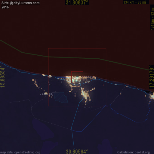
Analysis of Sirte night lights 2016
Square area 10x10 km:
 0%
0%90-99
0%80-89
18.13%70-79
5.31%60-69
3.48%50-59
1.83%40-49
8.42%30-39
8.97%20-29
8.06%10-19
29.3%0-9
16.48%Square area 50x50 km:
0%90-99
0%80-89
1.75%70-79
0.91%60-69
0.9%50-59
0.65%40-49
1.32%30-39
1.56%20-29
1.85%10-19
6.32%0-9
84.75%Clear (daylight) street map image can be seen on geolist.org.
Map coordinates:
31° 48' 30.1" North, 15° 53' 7.9" East
31° 12' 32.1" North, 16° 35' 19.2" East
30° 36' 20.3" North, 17° 17' 30.4" East
Some cities around Sirte sort by population:
• Mişrātah
191.9 km =119.2 mi,  312°
312°
• Al Khums
271.7 km =168.8 mi, 306°
• Zliten
236.6 km =147 mi, 306°
• Bani Walid
254.1 km =157.9 mi,  283°
283°
• Waddān
231.7 km =144 mi,  190°
190°
• Masallātah
290.2 km =180.3 mi,  302°
302°
• Hūn
239.6 km =148.9 mi, 194°
• Al Burayqah
298.7 km =185.6 mi,  107°
107°
2210554 (p: 128,123)
Sources (retrieved 2019-11-25):
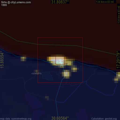
» NASA, Earths city lights 1995
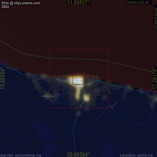
» NASA city lights 2003
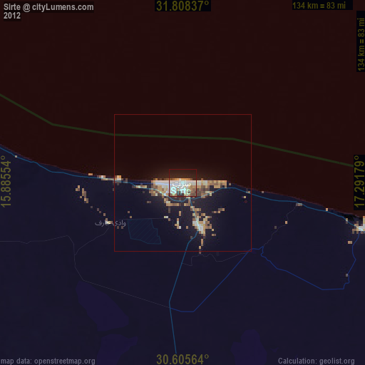
» Earth at Night: Flat Maps 2012, 2016