Waddān night lights from space
Night Light of Waddān (Al Jufrah) from space (Libya) Src. Average luminocity for 10x10km area is 24.5595% and for 50x50km: 3.5096%.
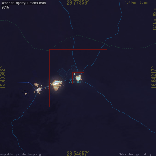
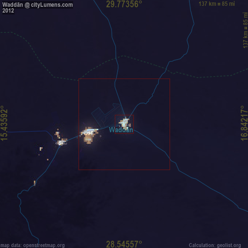
Analysis of Waddān night lights 2016
Square area 10x10 km:
 2.78%
2.78%90-99
3.97%80-89
7.14%70-79
3.57%60-69
2.78%50-59
0.4%40-49
1.19%30-39
1.98%20-29
2.38%10-19
20.63%0-9
53.17%Square area 50x50 km:
0.36%90-99
0.41%80-89
0.83%70-79
0.53%60-69
0.43%50-59
0.31%40-49
0.34%30-39
0.3%20-29
0.6%10-19
3.23%0-9
92.68%Clear (daylight) street map image can be seen on geolist.org.
Map coordinates:
29° 46' 24.8" North, 15° 26' 9.3" East
29° 9' 41" North, 16° 8' 20.5" East
28° 32' 44.1" North, 16° 50' 31.8" East
Some cities around Waddān sort by population:
• Sabhā
289.7 km =180 mi,  215°
215°
• Sirte
231.7 km =144 mi,  10°
10°
• Al Jadīd
290.2 km =180.3 mi, 215°
• Bani Walid
353.9 km =219.9 mi,  324°
324°
• Brak
256 km =159.1 mi,  225°
225°
• Hūn
19 km =11.8 mi,  258°
258°
• Al Burayqah
359.2 km =223.2 mi,  67°
67°
• Idrī
357.3 km =222 mi,  237°
237°
2209055 (p: 27,590)
Sources (retrieved 2019-11-25):
» Earth at Night: Flat Maps 2012, 2016