Mişrātah night lights from space
Night Light of Mişrātah from space (Libya) Src. Average luminocity for 10x10km area is 91.2692% and for 50x50km: 18.9341%.
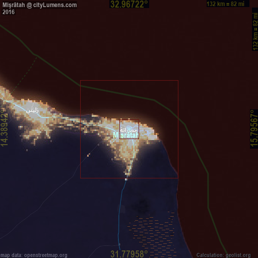
Analysis of Mişrātah night lights 2016
Square area 10x10 km:
 51.47%
90-99
27.66%80-89
6.59%70-79
3.3%60-69
1.83%50-59
1.65%40-49
1.28%30-39
5.13%20-29
1.1%10-19
0%0-9
0%Square area 50x50 km:
3.63%90-99
2.94%80-89
4.49%70-79
2.69%60-69
1.84%50-59
1.74%40-49
2.32%30-39
2.42%20-29
4.31%10-19
7.66%0-9
65.96%Clear (daylight) street map image can be seen on geolist.org.
Map coordinates:
32° 58' 2" North, 14° 23' 21.9" East
32° 22' 31.3" North, 15° 5' 33.1" East
31° 46' 46.5" North, 15° 47' 44.4" East
Some cities around Mişrātah sort by population:
• Tripoli
187.3 km =116.4 mi,  287°
287°
• Tarhuna
137.2 km =85.3 mi,  272°
272°
• Al Khums
83.6 km =51.9 mi, 291°
• Sirte
191.9 km =119.2 mi,  132°
132°
• Zliten
50.2 km =31.2 mi,  281°
281°
• Tagiura
172.6 km =107.2 mi, 289°
• Bani Walid
125.8 km =78.2 mi,  236°
236°
• Masallātah
105.9 km =65.8 mi, 284°
2214846 (p: 386,120)
Sources (retrieved 2019-11-25):
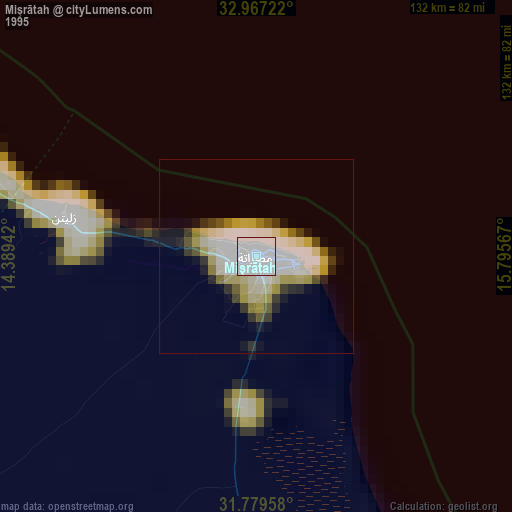
» NASA, Earths city lights 1995
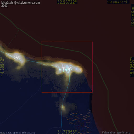
» NASA city lights 2003
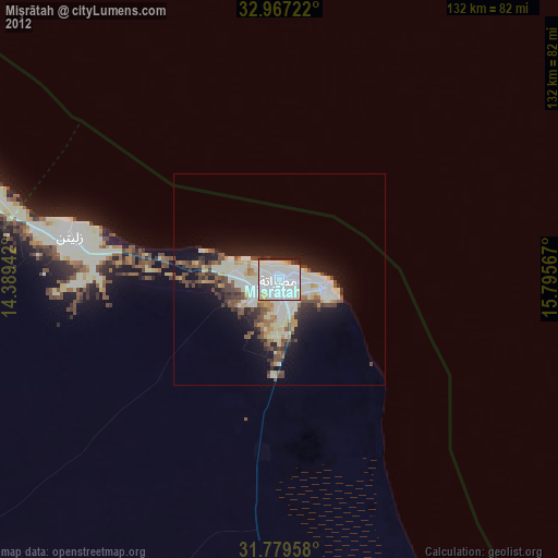
» Earth at Night: Flat Maps 2012, 2016