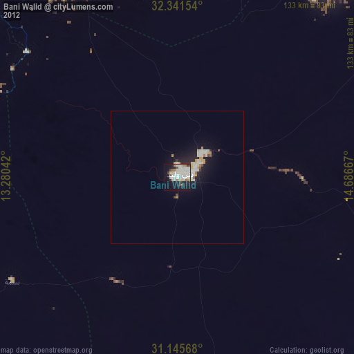
Bani Walid night lights from space
Night Light of Bani Walid (Mişrātah) from space (Libya) Src. Average luminocity for 10x10km area is 57.8773% and for 50x50km: 5.4777%.
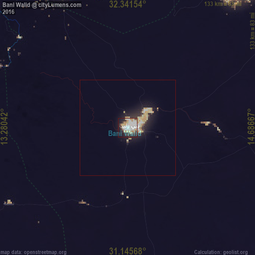
Analysis of Bani Walid night lights 2016
Square area 10x10 km:
 15.75%
90-99
17.4%80-89
8.61%70-79
6.59%60-69
2.75%50-59
1.65%40-49
3.85%30-39
6.78%20-29
15.38%10-19
18.13%0-9
3.11%Square area 50x50 km:
0.82%90-99
1.06%80-89
1.12%70-79
0.98%60-69
0.26%50-59
0.13%40-49
0.34%30-39
0.65%20-29
1.8%10-19
4.15%0-9
88.68%Clear (daylight) street map image can be seen on geolist.org.
Map coordinates:
32° 20' 29.5" North, 13° 16' 49.5" East
31° 44' 43.9" North, 13° 59' 0.7" East
31° 8' 44.4" North, 14° 41' 12" East
Some cities around Bani Walid sort by population:
• Mişrātah
125.8 km =78.2 mi,  56°
56°
• Tarhuna
83.5 km =51.9 mi,  336°
336°
• Al Khums
103.8 km =64.5 mi,  14°
14°
• Zliten
97.4 km =60.5 mi,  34°
34°
• Gharyan
102.5 km =63.7 mi,  297°
297°
• Mizdah
100.1 km =62.2 mi,  250°
250°
• Masallātah
96.9 km =60.2 mi,  0°
0°
• Al ‘Azīzīyah
126.2 km =78.4 mi,  313°
313°
2218840 (p: 46,350)
Sources (retrieved 2019-11-25):
» Earth at Night: Flat Maps 2012, 2016