Zliten night lights from space
Night Light of Zliten (Mişrātah) from space (Libya) Src. Average luminocity for 10x10km area is 87.5495% and for 50x50km: 18.9428%.
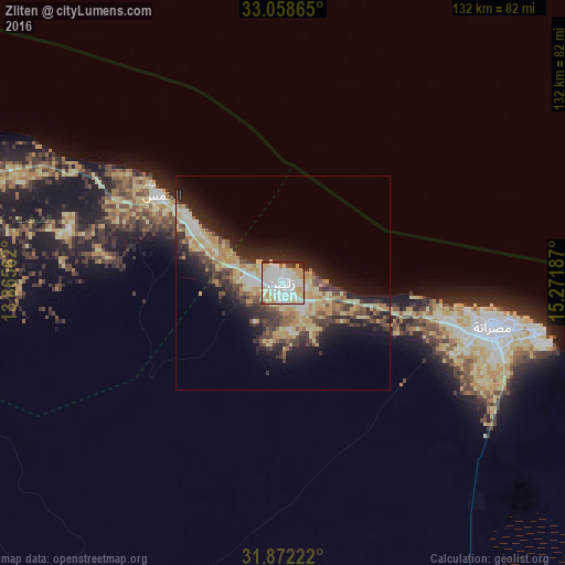
Analysis of Zliten night lights 2016
Square area 10x10 km:
 33.15%
90-99
30.95%80-89
13.19%70-79
11.72%60-69
1.65%50-59
1.1%40-49
1.83%30-39
3.66%20-29
2.75%10-19
0%0-9
0%Square area 50x50 km:
2.12%90-99
2.78%80-89
4.24%70-79
3.42%60-69
2.25%50-59
1.62%40-49
2.92%30-39
3.41%20-29
5.53%10-19
8.81%0-9
62.89%Clear (daylight) street map image can be seen on geolist.org.
Map coordinates:
33° 3' 31.1" North, 13° 51' 56.2" East
32° 28' 2.6" North, 14° 34' 7.5" East
31° 52' 20" North, 15° 16' 18.7" East
Some cities around Zliten sort by population:
• Tripoli
137.5 km =85.4 mi,  289°
289°
• Mişrātah
50.2 km =31.2 mi,  101°
101°
• Tarhuna
87.9 km =54.6 mi,  267°
267°
• Al Khums
35.1 km =21.8 mi,  305°
305°
• Tagiura
123 km =76.4 mi, 291°
• Bani Walid
97.4 km =60.5 mi,  214°
214°
• Masallātah
55.8 km =34.7 mi, 287°
• Al ‘Azīzīyah
145.6 km =90.5 mi, 272°
2208485 (p: 109,972)
Sources (retrieved 2019-11-25):
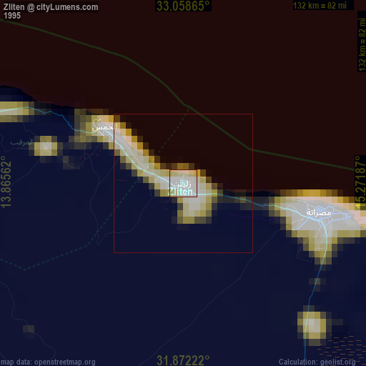
» NASA, Earths city lights 1995
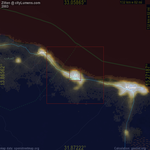
» NASA city lights 2003
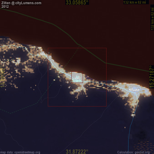
» Earth at Night: Flat Maps 2012, 2016