Hūn night lights from space
Night Light of Hūn (Al Jufrah) from space (Libya) Src. Average luminocity for 10x10km area is 49.6071% and for 50x50km: 4.67%.
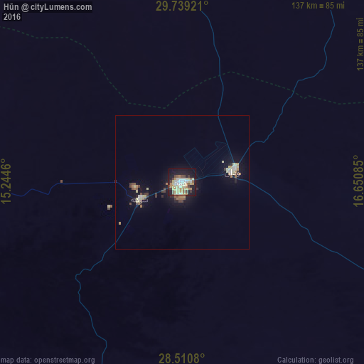
Analysis of Hūn night lights 2016
Square area 10x10 km:
 6.75%
6.75%90-99
6.94%80-89
14.29%70-79
9.33%60-69
6.35%50-59
4.76%40-49
4.96%30-39
4.56%20-29
8.53%10-19
29.37%0-9
4.17%Square area 50x50 km:
0.41%90-99
0.46%80-89
1.12%70-79
0.59%60-69
0.57%50-59
0.45%40-49
0.57%30-39
0.54%20-29
0.78%10-19
3.93%0-9
90.59%Clear (daylight) street map image can be seen on geolist.org.
Map coordinates:
29° 44' 21.2" North, 15° 14' 40.6" East
29° 7' 36.6" North, 15° 56' 51.8" East
28° 30' 38.9" North, 16° 39' 3.1" East
Some cities around Hūn sort by population:
• Mişrātah
370.3 km =230.1 mi,  347°
347°
• Sabhā
276 km =171.5 mi,  212°
212°
• Sirte
239.6 km =148.9 mi,  14°
14°
• Al Jadīd
276.4 km =171.7 mi, 213°
• Bani Walid
346.7 km =215.4 mi,  327°
327°
• Brak
240.1 km =149.2 mi,  223°
223°
• Waddān
19 km =11.8 mi,  78°
78°
• Idrī
339.5 km =211 mi,  236°
236°
2216645 (p: 18,878)
Sources (retrieved 2019-11-25):
» Earth at Night: Flat Maps 2012, 2016