Ban Houakhoua night lights from space
Night Light of Ban Houakhoua (Bokeo) from space (Laos) Src. Average luminocity for 10x10km area is 33.1766% and for 50x50km: 2.5659%.
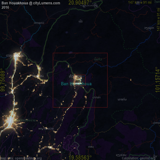
Analysis of Ban Houakhoua night lights 2016
Square area 10x10 km:
 1.39%
1.39%90-99
8.13%80-89
4.76%70-79
4.96%60-69
2.98%50-59
6.35%40-49
7.34%30-39
4.76%20-29
7.74%10-19
19.84%0-9
31.75%Square area 50x50 km:
0.06%90-99
0.32%80-89
0.25%70-79
0.43%60-69
0.28%50-59
0.48%40-49
0.56%30-39
0.5%20-29
0.74%10-19
1.79%0-9
94.59%Clear (daylight) street map image can be seen on geolist.org.
Map coordinates:
20° 54' 17.9" North, 99° 45' 3.2" East
20° 14' 48.1" North, 100° 27' 14.4" East
19° 35' 8.3" North, 101° 9' 25.7" East
Some cities around Ban Houakhoua sort by population:
• Chiang Rai, TH
75 km =46.6 mi,  239°
239°
• Tachilek, MM
63.8 km =39.6 mi,  290°
290°
• Mae Chan, TH
63.7 km =39.6 mi,  259°
259°
• Mae Sai, TH
63.7 km =39.6 mi, 289°
• Chiang Khong, TH
5.4 km =3.4 mi, 287°
• Chiang Kham, TH
82 km =51 mi,  191°
191°
• Pa Daet, TH
95.6 km =59.4 mi,  210°
210°
• Chiang Saen, TH
38.4 km =23.9 mi,  274°
274°
1904391 (p: 15,500)
Sources (retrieved 2019-11-25):
» Earth at Night: Flat Maps 2012, 2016