Mae Chan night lights from space
Night Light of Mae Chan (Chiang Rai) from space (Thailand) Src. Average luminocity for 10x10km area is 22.4484% and for 50x50km: 8.1582%.
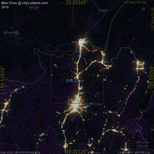
Analysis of Mae Chan night lights 2016
Square area 10x10 km:
 0.4%
0.4%90-99
2.78%80-89
4.76%70-79
0.79%60-69
3.77%50-59
0.99%40-49
6.15%30-39
6.94%20-29
7.94%10-19
18.45%0-9
47.02%Square area 50x50 km:
0.2%90-99
1.2%80-89
1.43%70-79
0.72%60-69
1.19%50-59
0.71%40-49
2.03%30-39
1.6%20-29
1.93%10-19
6.07%0-9
82.91%Clear (daylight) street map image can be seen on geolist.org.
Map coordinates:
20° 48' 19.6" North, 99° 8' 58" East
20° 8' 48.3" North, 99° 51' 9.2" East
19° 29' 6.9" North, 100° 33' 20.5" East
Some cities around Mae Chan sort by population:
• Chiang Rai
26.6 km =16.5 mi,  184°
184°
• Tachilek, MM
33.6 km =20.9 mi,  5°
5°
• Mae Sai
32 km =19.9 mi,  4°
4°
• Ban Houakhoua, LA
63.7 km =39.6 mi,  79°
79°
• Chiang Khong
59 km =36.7 mi, 77°
• Ban Houayxay, LA
60.6 km =37.7 mi, 76°
• Chiang Saen
28.3 km =17.6 mi,  59°
59°
• Fang
71.4 km =44.4 mi,  249°
249°
1152227 (p: 37,672)
Sources (retrieved 2019-11-25):
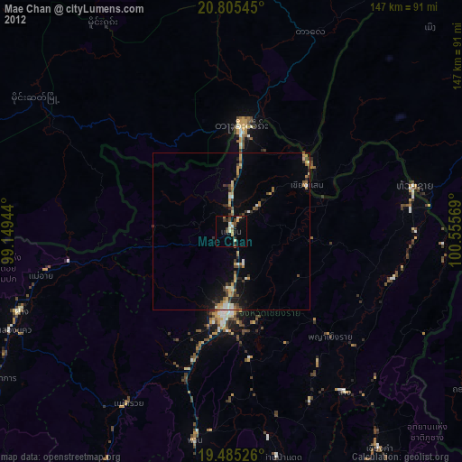
» Earth at Night: Flat Maps 2012, 2016