Tachilek night lights from space
Night Light of Tachilek (Shan) from space (Myanmar) Src. Average luminocity for 10x10km area is 45.017% and for 50x50km: 6.2532%.
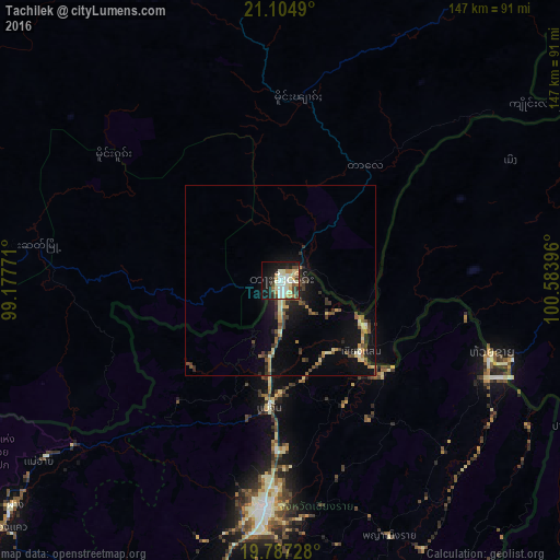
Analysis of Tachilek night lights 2016
Square area 10x10 km:
 7.2%
7.2%90-99
12.31%80-89
7.95%70-79
5.87%60-69
3.03%50-59
2.65%40-49
7.58%30-39
4.55%20-29
9.09%10-19
26.52%0-9
13.26%Square area 50x50 km:
0.34%90-99
0.82%80-89
0.95%70-79
0.73%60-69
0.73%50-59
0.62%40-49
1.38%30-39
1.12%20-29
1.56%10-19
5.17%0-9
86.58%Clear (daylight) street map image can be seen on geolist.org.
Map coordinates:
21° 6' 17.6" North, 99° 10' 39.8" East
20° 26' 51" North, 99° 52' 51" East
19° 47' 14.2" North, 100° 35' 2.3" East
Some cities around Tachilek sort by population:
• Chiang Rai, TH
60.1 km =37.3 mi,  184°
184°
• Mae Chan, TH
33.6 km =20.9 mi,  185°
185°
• Mae Sai, TH
1.6 km =1 mi,  197°
197°
• Ban Houakhoua, LA
63.8 km =39.6 mi,  110°
110°
• Chiang Khong, TH
58.4 km =36.3 mi, 110°
• Ban Houayxay, LA
59.4 km =36.9 mi, 109°
• Chiang Saen, TH
28.8 km =17.9 mi,  131°
131°
• Fang, TH
91.2 km =56.7 mi,  229°
229°
1295301 (p: 51,553)
Sources (retrieved 2019-11-25):
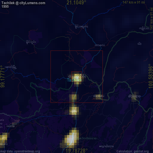
» NASA, Earths city lights 1995
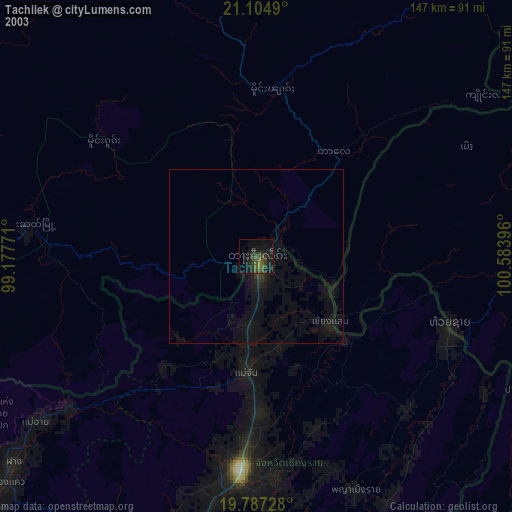
» NASA city lights 2003
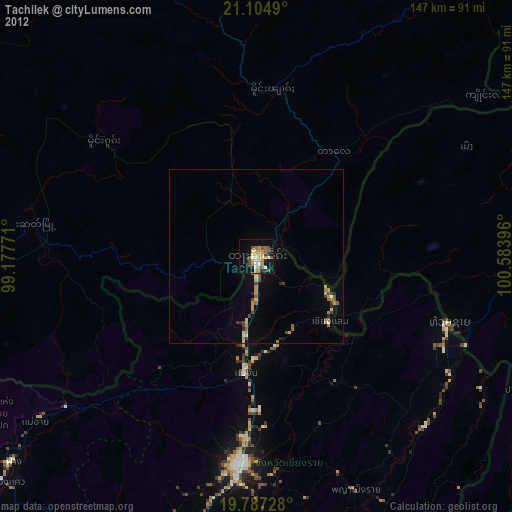
» Earth at Night: Flat Maps 2012, 2016