Mae Sai night lights from space
Night Light of Mae Sai (Chiang Rai) from space (Thailand) Src. Average luminocity for 10x10km area is 46.8655% and for 50x50km: 6.4417%.
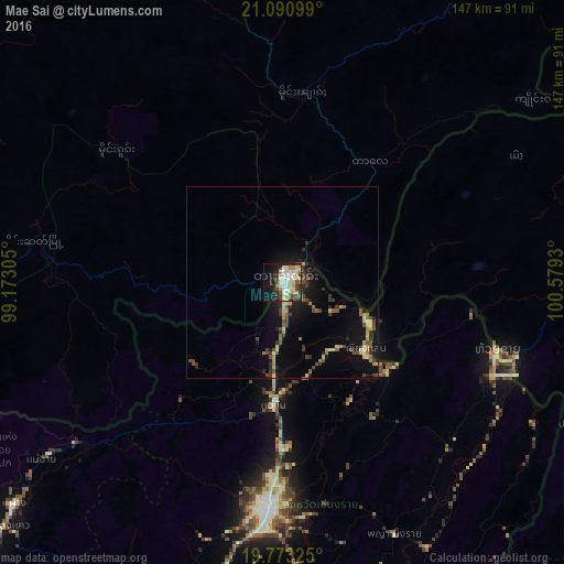
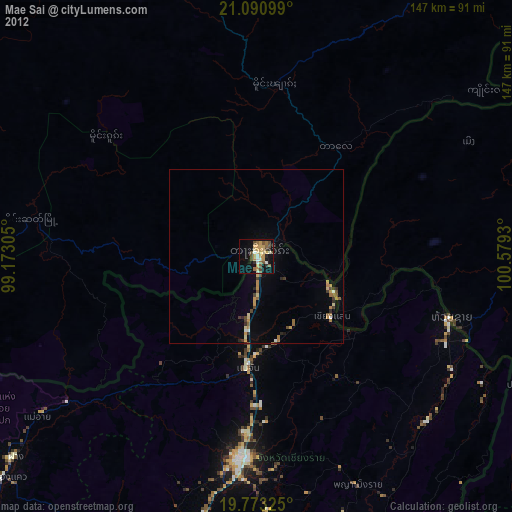
Analysis of Mae Sai night lights 2016
Square area 10x10 km:
 7.2%
7.2%90-99
12.31%80-89
9.47%70-79
5.87%60-69
3.79%50-59
2.65%40-49
7.58%30-39
6.06%20-29
9.66%10-19
21.59%0-9
13.83%Square area 50x50 km:
0.34%90-99
0.83%80-89
1.02%70-79
0.73%60-69
0.73%50-59
0.62%40-49
1.44%30-39
1.19%20-29
1.6%10-19
5.26%0-9
86.23%Clear (daylight) street map image can be seen on geolist.org.
Map coordinates:
21° 5' 27.6" North, 99° 10' 23" East
20° 26' 0.7" North, 99° 52' 34.2" East
19° 46' 23.7" North, 100° 34' 45.5" East
Some cities around Mae Sai sort by population:
• Chiang Rai
58.5 km =36.4 mi,  184°
184°
• Tachilek, MM
1.6 km =1 mi,  17°
17°
• Mae Chan
32 km =19.9 mi, 184°
• Ban Houakhoua, LA
63.7 km =39.6 mi,  109°
109°
• Chiang Khong
58.3 km =36.2 mi, 109°
• Ban Houayxay, LA
59.3 km =36.8 mi, 107°
• Chiang Saen
28.2 km =17.5 mi,  128°
128°
• Fang
89.8 km =55.8 mi,  230°
230°
1152194 (p: 27,520)
Sources (retrieved 2019-11-25):
» Earth at Night: Flat Maps 2012, 2016