Shubarshi night lights from space
Night Light of Shubarshi (Aqtöbe) from space (Kazakhstan) Src. Average luminocity for 10x10km area is 3.2247% and for 50x50km: 1.6572%.
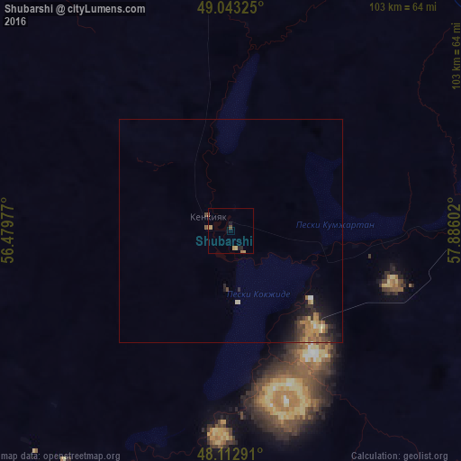
Analysis of Shubarshi night lights 2016
Square area 10x10 km:
 0%
0%90-99
0%80-89
0.74%70-79
1.64%60-69
0.3%50-59
0.3%40-49
0.6%30-39
0%20-29
0.89%10-19
0.89%0-9
94.64%Square area 50x50 km:
0.04%90-99
0.03%80-89
0.29%70-79
0.32%60-69
0.4%50-59
0.26%40-49
0.32%30-39
0.28%20-29
0.55%10-19
1.21%0-9
96.28%Clear (daylight) street map image can be seen on geolist.org.
Map coordinates:
49° 2' 35.7" North, 56° 28' 47.2" East
48° 34' 48.8" North, 57° 10' 58.4" East
48° 6' 46.5" North, 57° 53' 9.7" East
Some cities around Shubarshi sort by population:
• Aktobe
189 km =117.4 mi,  0°
0°
• Kandyagash
100.3 km =62.3 mi,  9°
9°
• Shalqar
197.4 km =122.7 mi,  114°
114°
• Khromtau
206.8 km =128.5 mi,  26°
26°
• Embi
76.2 km =47.3 mi,  68°
68°
• Martuk
245.8 km =152.7 mi,  348°
348°
• Bayganin
96.9 km =60.2 mi,  277°
277°
• Batamshinskiy
233.9 km =145.3 mi,  19°
19°
608270 (p: 8,651)
Sources (retrieved 2019-11-25):
» Earth at Night: Flat Maps 2012, 2016