Kostanay night lights from space
Night Light of Kostanay (Qostanay) from space (Kazakhstan) Src. Average luminocity for 10x10km area is 51.2071% and for 50x50km: 2.7769%.
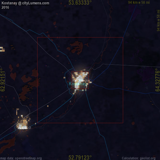
Analysis of Kostanay night lights 2016
Square area 10x10 km:
 10.86%
90-99
13.64%80-89
6.31%70-79
5.68%60-69
2.9%50-59
6.82%40-49
6.19%30-39
3.03%20-29
20.83%10-19
21.21%0-9
2.53%Square area 50x50 km:
0.47%90-99
0.57%80-89
0.31%70-79
0.23%60-69
0.14%50-59
0.41%40-49
0.37%30-39
0.24%20-29
1.02%10-19
2.18%0-9
94.07%Clear (daylight) street map image can be seen on geolist.org.
Map coordinates:
53° 37' 60" North, 62° 55' 17.4" East
53° 12' 51.7" North, 63° 37' 28.7" East
52° 47' 28.4" North, 64° 19' 39.9" East
Some cities around Kostanay sort by population:
• Rudnyy
43.3 km =26.9 mi,  231°
231°
• Lisakovsk
105.8 km =65.7 mi, 225°
• Qashar
53.1 km =33 mi,  288°
288°
• Komsomolets
119.5 km =74.3 mi,  299°
299°
• Borovskoy
74.1 km =46 mi,  29°
29°
• Fyodorovka
77.5 km =48.2 mi,  307°
307°
• Qusmuryn
108 km =67.1 mi,  141°
141°
• Tobol
90.2 km =56 mi, 230°
1519928 (p: 210,000)
Sources (retrieved 2019-11-25):
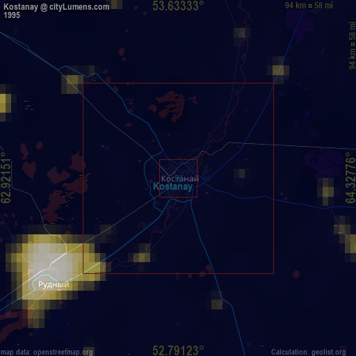
» NASA, Earths city lights 1995
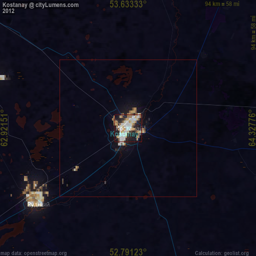
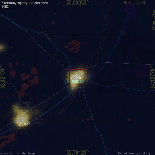
» NASA city lights 2003
» Earth at Night: Flat Maps 2012, 2016