Ekibastuz night lights from space
Night Light of Ekibastuz (Pavlodar Region) from space (Kazakhstan) Src. Average luminocity for 10x10km area is 46.43% and for 50x50km: 4.2346%.

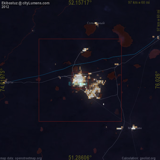
Analysis of Ekibastuz night lights 2016
Square area 10x10 km:
 13.31%
90-99
11.48%80-89
1.54%70-79
5.88%60-69
3.92%50-59
2.8%40-49
3.08%30-39
5.74%20-29
18.63%10-19
27.87%0-9
5.74%Square area 50x50 km:
0.79%90-99
0.68%80-89
0.17%70-79
0.65%60-69
0.45%50-59
0.39%40-49
0.49%30-39
0.51%20-29
1.35%10-19
4.26%0-9
90.26%Clear (daylight) street map image can be seen on geolist.org.
Map coordinates:
52° 9' 25.8" North, 74° 37' 11.1" East
51° 43' 25.4" North, 75° 19' 22.3" East
51° 17' 9.8" North, 76° 1' 33.6" East
Some cities around Ekibastuz sort by population:
• Pavlodar
128.6 km =79.9 mi,  61°
61°
• Aksu
115.6 km =71.8 mi,  72°
72°
• Yermentau
153.5 km =95.4 mi,  265°
265°
• Qashyr
158.4 km =98.4 mi,  19°
19°
• Leninskiy
116 km =72.1 mi, 59°
• Mayqayyng
44.2 km =27.5 mi,  131°
131°
• Bayanaul
106.8 km =66.4 mi,  165°
165°
• Kalkaman
54.7 km =34 mi, 62°
1524325 (p: 121,470)
Sources (retrieved 2019-11-25):
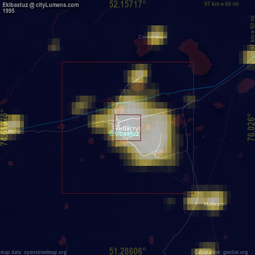
» NASA, Earths city lights 1995
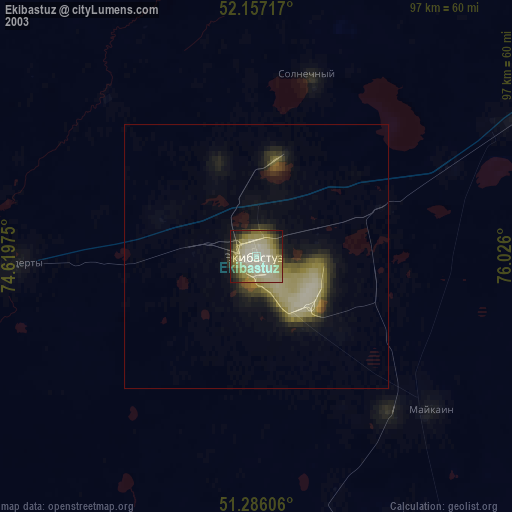
» NASA city lights 2003
» Earth at Night: Flat Maps 2012, 2016