Pavlodar night lights from space
Night Light of Pavlodar (Pavlodar Region) from space (Kazakhstan) Src. Average luminocity for 10x10km area is 65.5114% and for 50x50km: 6.2297%.
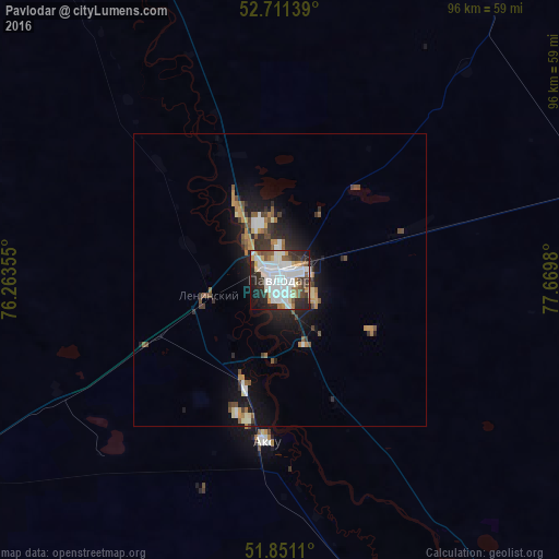


Analysis of Pavlodar night lights 2016
Square area 10x10 km:
 21.46%
90-99
21.97%80-89
4.29%70-79
4.55%60-69
4.55%50-59
6.31%40-49
2.9%30-39
7.95%20-29
16.29%10-19
8.08%0-9
1.64%Square area 50x50 km:
1.14%90-99
1.18%80-89
0.45%70-79
0.72%60-69
0.63%50-59
0.93%40-49
0.71%30-39
0.9%20-29
1.77%10-19
4.16%0-9
87.41%Clear (daylight) street map image can be seen on geolist.org.
Map coordinates:
52° 42' 41" North, 76° 15' 48.8" East
52° 16' 60" North, 76° 58' 0" East
51° 51' 4" North, 77° 40' 11.3" East
Some cities around Pavlodar sort by population:
• Ekibastuz
128.6 km =79.9 mi,  241°
241°
• Aksu
27.2 km =16.9 mi,  185°
185°
• Yarovoye, RU
130.4 km =81 mi,  56°
56°
• Kulunda, RU
137.3 km =85.3 mi,  76°
76°
• Qashyr
104.7 km =65.1 mi,  326°
326°
• Leninskiy
13 km =8.1 mi,  255°
255°
• Mayqayyng
121.5 km =75.5 mi,  221°
221°
• Kalkaman
73.9 km =45.9 mi, 240°
1520240 (p: 329,002)
Sources (retrieved 2019-11-25):
» NASA, Earths city lights 1995
» NASA city lights 2003
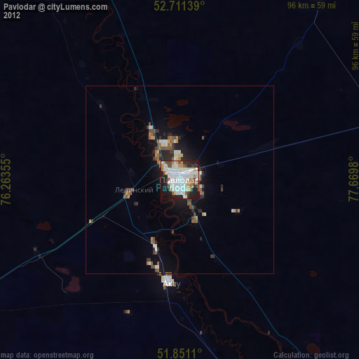
» Earth at Night: Flat Maps 2012, 2016