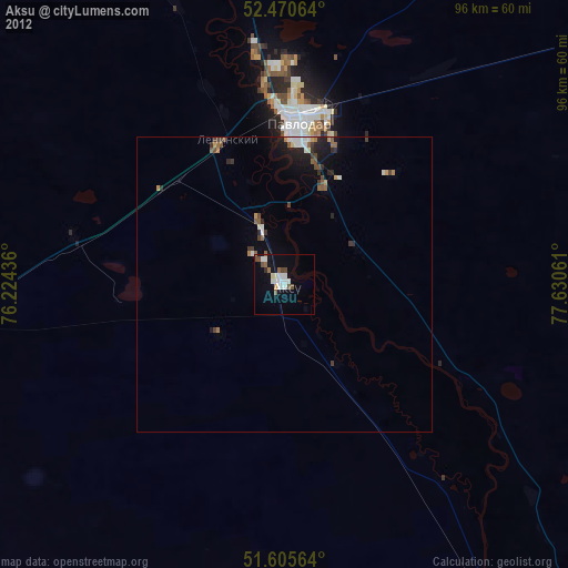
Aksu night lights from space
Night Light of Aksu (Pavlodar Region) from space (Kazakhstan) Src. Average luminocity for 10x10km area is 16.0846% and for 50x50km: 2.543%.
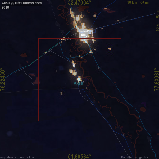
Analysis of Aksu night lights 2016
Square area 10x10 km:
 1.89%
1.89%90-99
3.54%80-89
1.89%70-79
1.26%60-69
3.16%50-59
1.14%40-49
1.14%30-39
1.89%20-29
1.01%10-19
15.28%0-9
67.8%Square area 50x50 km:
0.28%90-99
0.35%80-89
0.23%70-79
0.27%60-69
0.33%50-59
0.32%40-49
0.38%30-39
0.32%20-29
0.76%10-19
2.29%0-9
94.47%Clear (daylight) street map image can be seen on geolist.org.
Map coordinates:
52° 28' 14.3" North, 76° 13' 27.7" East
52° 2' 24.8" North, 76° 55' 38.9" East
51° 36' 20.3" North, 77° 37' 50.2" East
Some cities around Aksu sort by population:
• Pavlodar
27.2 km =16.9 mi,  5°
5°
• Ekibastuz
115.6 km =71.8 mi,  252°
252°
• Yarovoye, RU
149.2 km =92.7 mi,  48°
48°
• Kulunda, RU
148.7 km =92.4 mi,  66°
66°
• Qashyr
126.9 km =78.9 mi,  334°
334°
• Leninskiy
25.7 km =16 mi,  337°
337°
• Mayqayyng
100.8 km =62.6 mi,  230°
230°
• Kalkaman
62.4 km =38.8 mi,  261°
261°
1524298 (p: 44,808)
Sources (retrieved 2019-11-25):
» Earth at Night: Flat Maps 2012, 2016