Beyneu night lights from space
Night Light of Beyneu (Mangghystaū) from space (Kazakhstan) Src. Average luminocity for 10x10km area is 8.6444% and for 50x50km: 0.3431%.
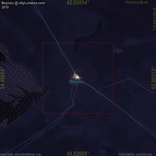
Analysis of Beyneu night lights 2016
Square area 10x10 km:
 0.16%
0.16%90-99
1.11%80-89
1.11%70-79
1.27%60-69
0.63%50-59
1.59%40-49
2.54%30-39
1.9%20-29
3.17%10-19
1.75%0-9
84.76%Square area 50x50 km:
0.01%90-99
0.04%80-89
0.04%70-79
0.05%60-69
0.02%50-59
0.06%40-49
0.1%30-39
0.07%20-29
0.12%10-19
0.07%0-9
99.42%Clear (daylight) street map image can be seen on geolist.org.
Map coordinates:
45° 48' 32.2" North, 54° 29' 48.8" East
45° 19' 0" North, 55° 12' 0" East
44° 49' 12.3" North, 55° 54' 11.3" East
Some cities around Beyneu sort by population:
• Zhanaozen
287.8 km =178.8 mi,  220°
220°
• Qulsary
203.4 km =126.4 mi,  333°
333°
• Balykshi
322 km =200.1 mi,  307°
307°
• Maqat
296.8 km =184.4 mi, 330°
• Shetpe
275 km =170.9 mi,  242°
242°
• Zhetibay
313.1 km =194.6 mi,  232°
232°
• Dossor
298.9 km =185.7 mi, 325°
• Qaraton
181.8 km =113 mi, 313°
610298 (p: 14,245)
Sources (retrieved 2019-11-25):
» Earth at Night: Flat Maps 2012, 2016