Qaraton night lights from space
Night Light of Qaraton (Atyraū) from space (Kazakhstan) Src. Average luminocity for 10x10km area is 4.939% and for 50x50km: 1.025%.
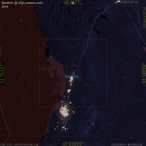
Analysis of Qaraton night lights 2016
Square area 10x10 km:
 0.6%
0.6%90-99
1.79%80-89
0.15%70-79
0.45%60-69
0.74%50-59
0.45%40-49
0%30-39
0%20-29
0.6%10-19
0%0-9
95.24%Square area 50x50 km:
0.09%90-99
0.21%80-89
0.12%70-79
0.03%60-69
0.08%50-59
0.09%40-49
0.14%30-39
0.09%20-29
0.26%10-19
0.75%0-9
98.15%Clear (daylight) street map image can be seen on geolist.org.
Map coordinates:
46° 55' 3.7" North, 52° 46' 59.8" East
46° 26' 7" North, 53° 29' 11" East
45° 56' 54.8" North, 54° 11' 22.3" East
Some cities around Qaraton sort by population:
• Atyrau
143.7 km =89.3 mi,  301°
301°
• Qulsary
70.5 km =43.8 mi,  35°
35°
• Balykshi
142 km =88.2 mi, 299°
• Beyneu
181.8 km =113 mi,  133°
133°
• Maqat
135.7 km =84.3 mi,  354°
354°
• Inderbor
267.7 km =166.3 mi,  331°
331°
• Dossor
127.3 km =79.1 mi,  342°
342°
• Makhambet
198.8 km =123.5 mi,  313°
313°
609537 (p: 8,905)
Sources (retrieved 2019-11-25):
» Earth at Night: Flat Maps 2012, 2016