Narok night lights from space
Night Light of Narok from space (Kenya) Src. Average luminocity for 10x10km area is 10.5368% and for 50x50km: 0.4453%.
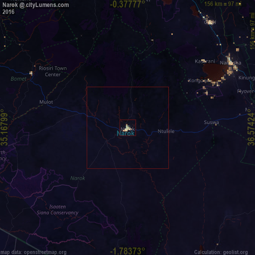
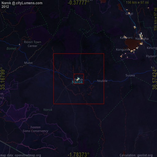
Analysis of Narok night lights 2016
Square area 10x10 km:
100  0%
0%
90-99 0%
80-89 5.19%
70-79 2.16%
60-69 2.16%
50-59 0%
40-49 2.38%
30-39 0.22%
20-29 0.87%
10-19 0%
0-9 87.01%
0%90-99
0%80-89
5.19%70-79
2.16%60-69
2.16%50-59
0%40-49
2.38%30-39
0.22%20-29
0.87%10-19
0%0-9
87.01%Square area 50x50 km:
100 0%
90-99 0%
80-89 0.21%
70-79 0.09%
60-69 0.09%
50-59 0%
40-49 0.1%
30-39 0.01%
20-29 0.03%
10-19 0.03%
0-9 99.45%
0%90-99
0%80-89
0.21%70-79
0.09%60-69
0.09%50-59
0%40-49
0.1%30-39
0.01%20-29
0.03%10-19
0.03%0-9
99.45%Clear (daylight) street map image can be seen on geolist.org.
Map coordinates:
0° 22' 40" South, 35° 10' 4.8" East
1° 4' 51" South, 35° 52' 16" East
1° 47' 1.4" South, 36° 34' 27.3" East
Some cities around Narok sort by population:
• Nakuru
88.9 km =55.2 mi,  14°
14°
• Naivasha
74.6 km =46.4 mi,  56°
56°
• Rongai
100.9 km =62.7 mi,  359°
359°
• Molo
93.8 km =58.3 mi,  350°
350°
• Magadi
102.3 km =63.6 mi,  153°
153°
• Ngong
93.8 km =58.3 mi,  108°
108°
• Limuru
85.8 km =53.3 mi,  92°
92°
• Sotik Post
67.6 km =42 mi,  299°
299°
184379 (p: 36,061)
Sources (retrieved 2019-11-25):
» Earth at Night: Flat Maps 2012, 2016