Nakuru night lights from space
Night Light of Nakuru from space (Kenya) Src. Average luminocity for 10x10km area is 49.9654% and for 50x50km: 5.0249%.
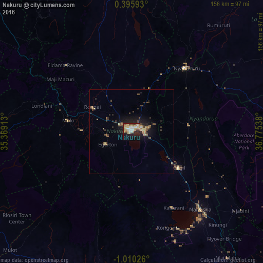
Analysis of Nakuru night lights 2016
Square area 10x10 km:
 8.44%
8.44%90-99
7.14%80-89
17.75%70-79
8.01%60-69
3.68%50-59
3.46%40-49
1.52%30-39
5.19%20-29
11.26%10-19
25.76%0-9
7.79%Square area 50x50 km:
0.35%90-99
0.32%80-89
1.38%70-79
0.55%60-69
0.4%50-59
0.62%40-49
0.98%30-39
0.87%20-29
1.51%10-19
3.94%0-9
89.08%Clear (daylight) street map image can be seen on geolist.org.
Map coordinates:
0° 23' 45.3" North, 35° 22' 8.9" East
0° 18' 25.9" South, 36° 4' 20.1" East
1° 0' 36.9" South, 36° 46' 31.4" East
Some cities around Nakuru sort by population:
• Ol Kalou
34.4 km =21.4 mi,  83°
83°
• Naivasha
60.4 km =37.5 mi,  138°
138°
• Nyahururu
50.2 km =31.2 mi,  40°
40°
• Rongai
27.6 km =17.1 mi,  302°
302°
• Molo
38.4 km =23.9 mi,  279°
279°
• Eldama Ravine
55.4 km =34.4 mi,  316°
316°
• Baringo
86.8 km =53.9 mi,  352°
352°
• Rumuruti
82.7 km =51.4 mi, 38°
184622 (p: 259,903)
Sources (retrieved 2019-11-25):
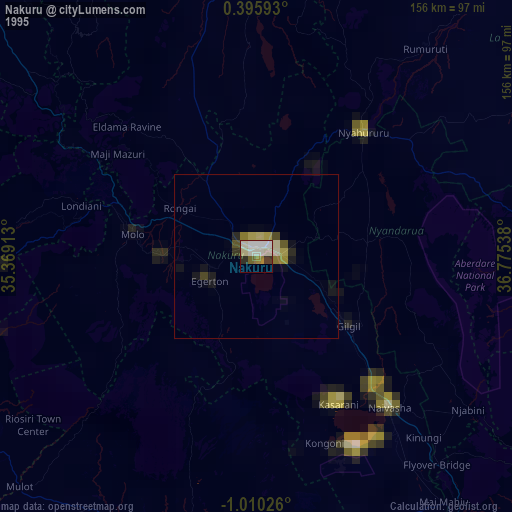
» NASA, Earths city lights 1995
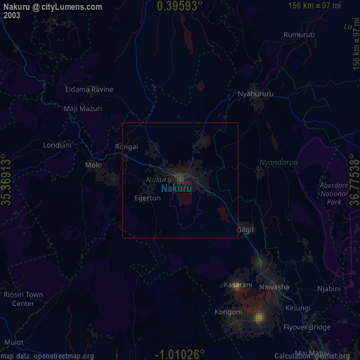
» NASA city lights 2003
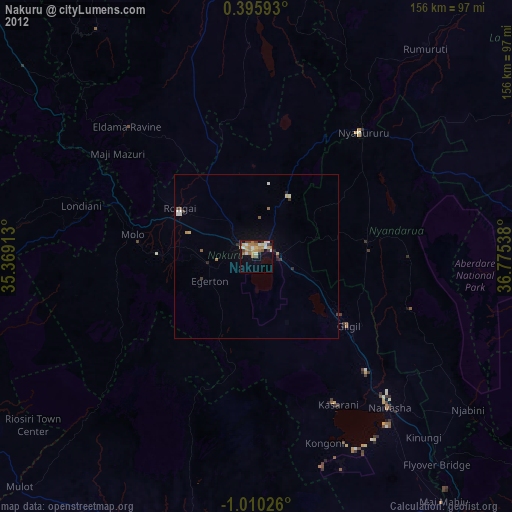
» Earth at Night: Flat Maps 2012, 2016