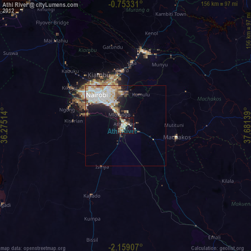
Athi River night lights from space
Night Light of Athi River (Machakos) from space (Kenya) Src. Average luminocity for 10x10km area is 50.2208% and for 50x50km: 20.3126%.
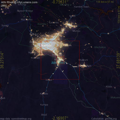
Analysis of Athi River night lights 2016
Square area 10x10 km:
 1.3%
1.3%90-99
3.9%80-89
18.61%70-79
12.99%60-69
6.93%50-59
3.46%40-49
6.71%30-39
10.17%20-29
19.7%10-19
15.37%0-9
0.87%Square area 50x50 km:
4.7%90-99
3.91%80-89
3.87%70-79
3.13%60-69
2.04%50-59
1.35%40-49
2.47%30-39
2.13%20-29
3.69%10-19
6.06%0-9
66.66%Clear (daylight) street map image can be seen on geolist.org.
Map coordinates:
0° 45' 11.9" South, 36° 16' 30.5" East
1° 27' 22.7" South, 36° 58' 41.7" East
2° 9' 32.7" South, 37° 40' 53" East
Some cities around Athi River sort by population:
• Nairobi
26.3 km =16.3 mi,  316°
316°
• Thika
48.1 km =29.9 mi,  12°
12°
• Machakos
32.7 km =20.3 mi,  102°
102°
• Pumwani
23.9 km =14.9 mi, 323°
• Kiambu
35.4 km =22 mi,  333°
333°
• Kajiado
49.4 km =30.7 mi,  206°
206°
• Kangundo
44.5 km =27.7 mi,  67°
67°
• Ngong
36.2 km =22.5 mi,  288°
288°
200787 (p: 24,530)
Sources (retrieved 2019-11-25):
» Earth at Night: Flat Maps 2012, 2016