Kiambu night lights from space
Night Light of Kiambu from space (Kenya) Src. Average luminocity for 10x10km area is 39.6385% and for 50x50km: 32.2432%.
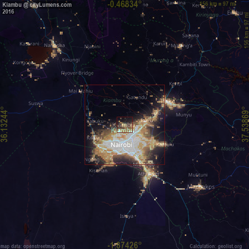
Analysis of Kiambu night lights 2016
Square area 10x10 km:
100  0.87%
0.87%
90-99 3.25%
80-89 2.81%
70-79 7.58%
60-69 14.72%
50-59 8.23%
40-49 11.47%
30-39 5.84%
20-29 13.85%
10-19 19.26%
0-9 12.12%
0.87%90-99
3.25%80-89
2.81%70-79
7.58%60-69
14.72%50-59
8.23%40-49
11.47%30-39
5.84%20-29
13.85%10-19
19.26%0-9
12.12%Square area 50x50 km:
100 5.9%
90-99 5.5%
80-89 4.65%
70-79 5.48%
60-69 5.67%
50-59 3.57%
40-49 5.4%
30-39 3.56%
20-29 6.78%
10-19 10.28%
0-9 43.22%
5.9%90-99
5.5%80-89
4.65%70-79
5.48%60-69
5.67%50-59
3.57%40-49
5.4%30-39
3.56%20-29
6.78%10-19
10.28%0-9
43.22%Clear (daylight) street map image can be seen on geolist.org.
Map coordinates:
0° 28' 6" South, 36° 7' 56.8" East
1° 10' 17" South, 36° 50' 8" East
1° 52' 27.3" South, 37° 32' 19.3" East
Some cities around Kiambu sort by population:
• Nairobi
12.6 km =7.8 mi,  189°
189°
• Thika
30.2 km =18.8 mi,  59°
59°
• Pumwani
12.5 km =7.8 mi,  172°
172°
• Athi River
35.4 km =22 mi,  153°
153°
• Murang’a
61.2 km =38 mi,  35°
35°
• Kangundo
58.8 km =36.5 mi,  104°
104°
• Ngong
27.3 km =17 mi,  222°
222°
• Limuru
22.5 km =14 mi,  286°
286°
192710 (p: 21,234)
Sources (retrieved 2019-11-25):
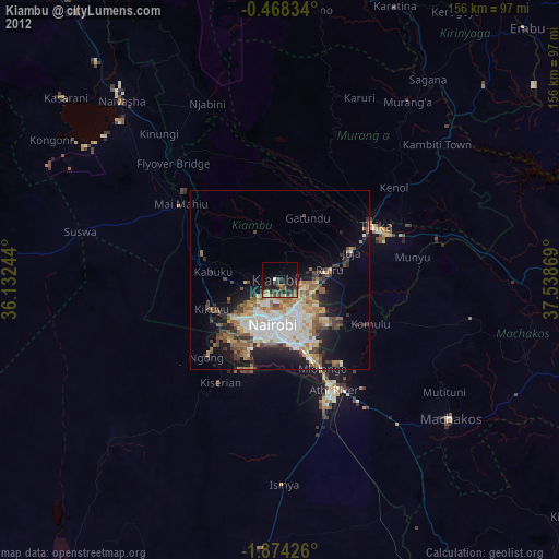
» Earth at Night: Flat Maps 2012, 2016