Shibata night lights from space
Night Light of Shibata (Niigata) from space (Japan) Src. Average luminocity for 10x10km area is 16.1347% and for 50x50km: 7.1059%.
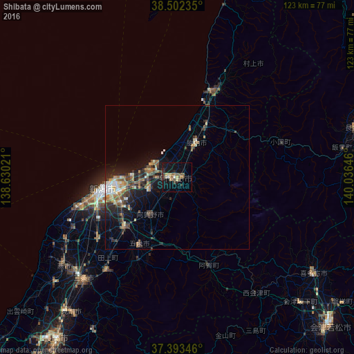

Analysis of Shibata night lights 2016
Square area 10x10 km:
 0.32%
0.32%90-99
1.62%80-89
1.3%70-79
2.76%60-69
1.79%50-59
3.57%40-49
4.71%30-39
2.27%20-29
3.08%10-19
14.45%0-9
64.12%Square area 50x50 km:
0.44%90-99
0.95%80-89
0.77%70-79
0.89%60-69
1.24%50-59
0.99%40-49
1.64%30-39
1.37%20-29
2.29%10-19
4.99%0-9
84.42%Clear (daylight) street map image can be seen on geolist.org.
Map coordinates:
38° 30' 8.5" North, 138° 37' 48.8" East
37° 57' 0" North, 139° 19' 60" East
37° 23' 36.5" North, 140° 2' 11.3" East
Some cities around Shibata sort by population:
• Niigata
29.6 km =18.4 mi,  256°
256°
• Niitsu-honchō
24.9 km =15.5 mi,  228°
228°
• Shirone
34.3 km =21.3 mi, 232°
• Gosen
28.2 km =17.5 mi,  211°
211°
• Kameda-honchō
21.4 km =13.3 mi,  246°
246°
• Murakami
34.1 km =21.2 mi,  22°
22°
• Suibara
14.7 km =9.1 mi,  218°
218°
• Muramatsu
32 km =19.9 mi, 206°
1852607 (p: 80,793)
Sources (retrieved 2019-11-25):
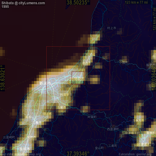
» NASA, Earths city lights 1995
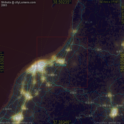
» NASA city lights 2003
» Earth at Night: Flat Maps 2012, 2016