Niitsu-honchō night lights from space
Night Light of Niitsu-honchō (Niigata) from space (Japan) Src. Average luminocity for 10x10km area is 13.5799% and for 50x50km: 11.1166%.
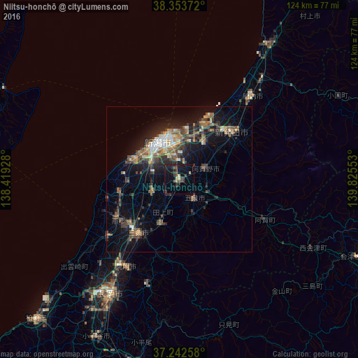
Analysis of Niitsu-honchō night lights 2016
Square area 10x10 km:
 0%
0%90-99
0.17%80-89
2.55%70-79
0.68%60-69
0.34%50-59
1.7%40-49
5.1%30-39
3.91%20-29
4.93%10-19
16.84%0-9
63.78%Square area 50x50 km:
0.72%90-99
1.42%80-89
1.03%70-79
1.13%60-69
1.93%50-59
1.87%40-49
2.63%30-39
2.31%20-29
3.6%10-19
8.03%0-9
75.33%Clear (daylight) street map image can be seen on geolist.org.
Map coordinates:
38° 21' 13.4" North, 138° 25' 9.4" East
37° 48' 0.9" North, 139° 7' 20.6" East
37° 14' 33.3" North, 139° 49' 31.9" East
Some cities around Niitsu-honchō sort by population:
• Niigata
14 km =8.7 mi,  313°
313°
• Shirone
9.7 km =6 mi,  245°
245°
• Gosen
8.4 km =5.2 mi,  152°
152°
• Kameda-honchō
8.1 km =5 mi,  352°
352°
• Kamo
16.9 km =10.5 mi,  206°
206°
• Maki
21.7 km =13.5 mi,  255°
255°
• Suibara
10.8 km =6.7 mi,  61°
61°
• Muramatsu
12.7 km =7.9 mi,  160°
160°
1855410 (p: 65,910)
Sources (retrieved 2019-11-25):
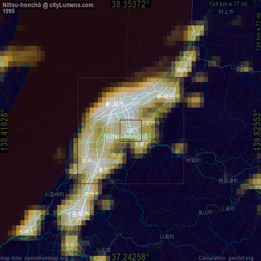
» NASA, Earths city lights 1995
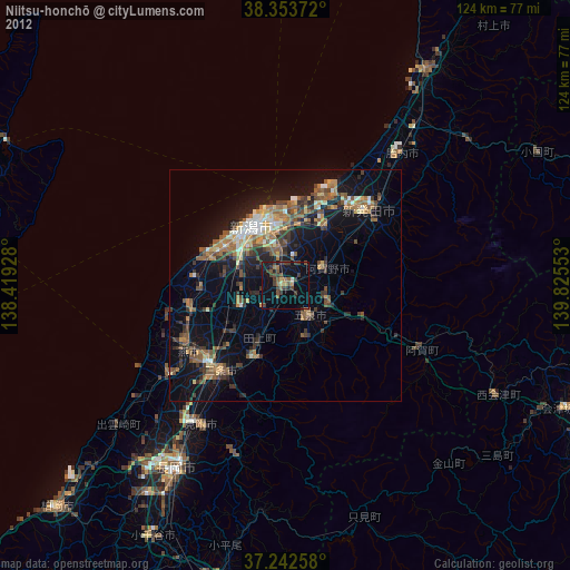
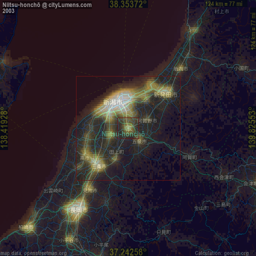
» NASA city lights 2003
» Earth at Night: Flat Maps 2012, 2016