Katori-shi night lights from space
Night Light of Katori-shi (Chiba) from space (Japan) Src. Average luminocity for 10x10km area is 20.1337% and for 50x50km: 18.1216%.
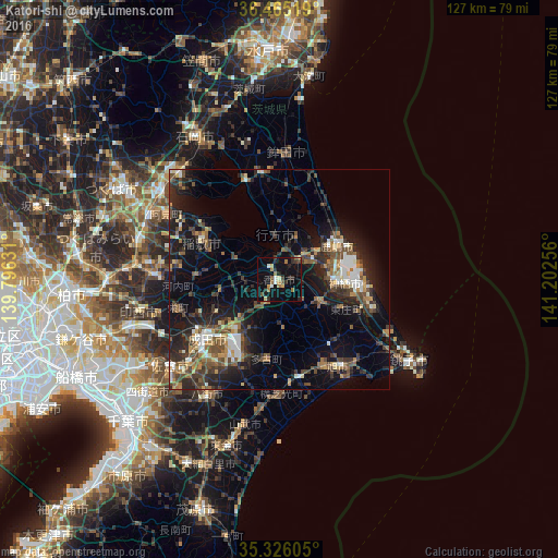
Analysis of Katori-shi night lights 2016
Square area 10x10 km:
 1.1%
1.1%90-99
2.01%80-89
2.75%70-79
1.83%60-69
4.76%50-59
1.47%40-49
1.65%30-39
4.4%20-29
6.23%10-19
17.77%0-9
56.04%Square area 50x50 km:
1.63%90-99
2.46%80-89
1.35%70-79
1.89%60-69
2.48%50-59
2.96%40-49
4.09%30-39
4.18%20-29
7.18%10-19
12.51%0-9
59.27%Clear (daylight) street map image can be seen on geolist.org.
Map coordinates:
36° 27' 54.7" North, 139° 47' 46.7" East
35° 53' 51.6" North, 140° 29' 57.9" East
35° 19' 33.8" North, 141° 12' 9.2" East
Some cities around Katori-shi sort by population:
• Narita
20.8 km =12.9 mi,  232°
232°
• Kashima-shi
15.1 km =9.4 mi,  60°
60°
• Sawara
1.6 km =1 mi,  178°
178°
• Inashiki
17.1 km =10.6 mi,  292°
292°
• Yōkaichiba
22.4 km =13.9 mi,  168°
168°
• Itako
6 km =3.7 mi,  48°
48°
• Omigawa
11.8 km =7.3 mi,  116°
116°
• Edosaki
17.5 km =10.9 mi, 289°
2112319 (p: 83,181)
Sources (retrieved 2019-11-25):
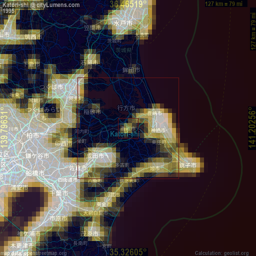
» NASA, Earths city lights 1995
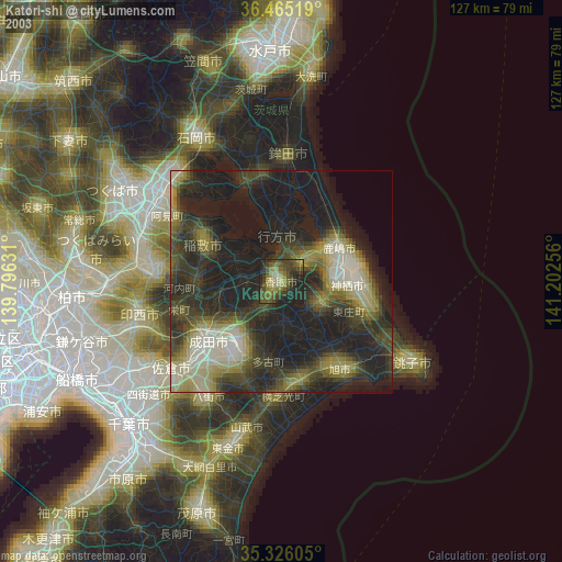
» NASA city lights 2003
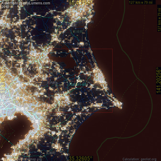
» Earth at Night: Flat Maps 2012, 2016