Itako night lights from space
Night Light of Itako (Ibaraki) from space (Japan) Src. Average luminocity for 10x10km area is 22.0348% and for 50x50km: 15.2404%.
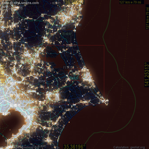
Analysis of Itako night lights 2016
Square area 10x10 km:
 0%
0%90-99
0.73%80-89
0.92%70-79
3.11%60-69
4.95%50-59
2.93%40-49
3.3%30-39
8.06%20-29
10.81%10-19
34.98%0-9
30.22%Square area 50x50 km:
1.5%90-99
2.22%80-89
1.16%70-79
1.49%60-69
2.27%50-59
2.69%40-49
3.12%30-39
3.28%20-29
4.9%10-19
9.88%0-9
67.49%Clear (daylight) street map image can be seen on geolist.org.
Map coordinates:
36° 30' 2.2" North, 139° 50' 48.8" East
35° 55' 60" North, 140° 33' 0" East
35° 21' 43.1" North, 141° 15' 11.3" East
Some cities around Itako sort by population:
• Katori-shi
6 km =3.7 mi,  228°
228°
• Kashima-shi
9.2 km =5.7 mi,  67°
67°
• Sawara
7.2 km =4.5 mi,  219°
219°
• Inashiki
20.5 km =12.7 mi,  277°
277°
• Asahi
25.7 km =16 mi,  159°
159°
• Yōkaichiba
25.9 km =16.1 mi,  180°
180°
• Omigawa
11 km =6.8 mi,  147°
147°
• Edosaki
21.1 km =13.1 mi, 275°
2112555 (p: 25,791)
Sources (retrieved 2019-11-25):
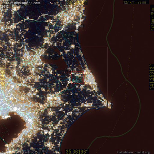
» Earth at Night: Flat Maps 2012, 2016