Narita night lights from space
Night Light of Narita (Chiba) from space (Japan) Src. Average luminocity for 10x10km area is 57.215% and for 50x50km: 32.8285%.
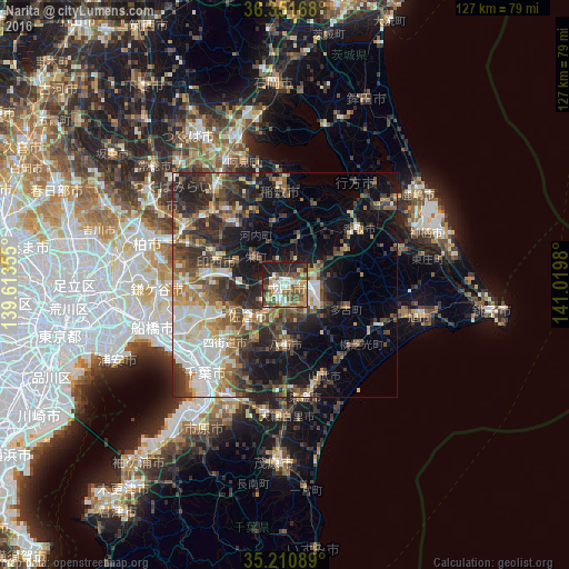
Analysis of Narita night lights 2016
Square area 10x10 km:
 8.04%
8.04%90-99
12.76%80-89
6.12%70-79
7.69%60-69
9.44%50-59
11.36%40-49
15.56%30-39
4.37%20-29
17.31%10-19
7.34%0-9
0%Square area 50x50 km:
4.86%90-99
6.12%80-89
2.99%70-79
3.83%60-69
4.85%50-59
4.98%40-49
6.47%30-39
6.95%20-29
10.66%10-19
13.2%0-9
35.1%Clear (daylight) street map image can be seen on geolist.org.
Map coordinates:
36° 21' 6" North, 139° 36' 48.8" East
35° 46' 60" North, 140° 19' 0" East
35° 12' 39.2" North, 141° 1' 11.3" East
Some cities around Narita sort by population:
• Sakura
10.6 km =6.6 mi,  225°
225°
• Yotsukaidō
20.1 km =12.5 mi,  222°
222°
• Ryūgasaki
17.7 km =11 mi,  317°
317°
• Yachimata
14.8 km =9.2 mi,  180°
180°
• Sawara
19.9 km =12.4 mi,  56°
56°
• Inashiki
19.2 km =11.9 mi,  1°
1°
• Edosaki
18.5 km =11.5 mi, 0°
• Shisui
8.7 km =5.4 mi,  211°
211°
2111684 (p: 100,641)
Sources (retrieved 2019-11-25):
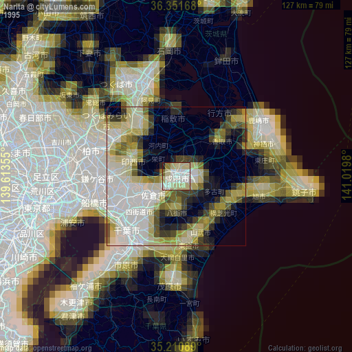
» NASA, Earths city lights 1995
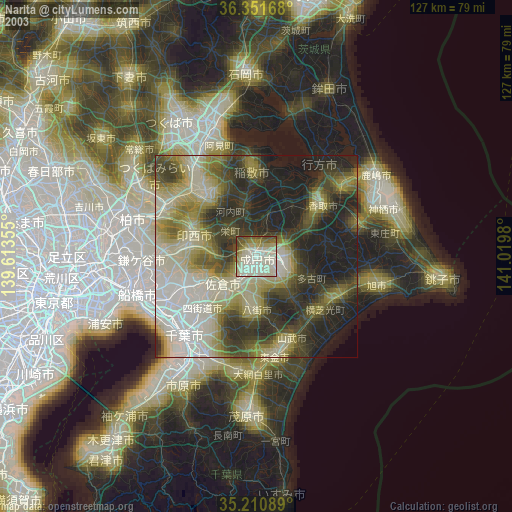
» NASA city lights 2003
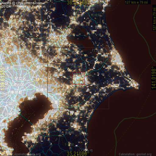
» Earth at Night: Flat Maps 2012, 2016