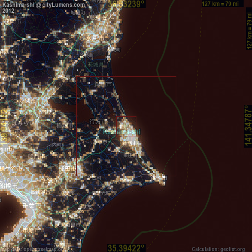
Kashima-shi night lights from space
Night Light of Kashima-shi (Ibaraki) from space (Japan) Src. Average luminocity for 10x10km area is 45.6264% and for 50x50km: 10.1287%.


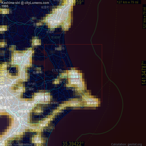
Analysis of Kashima-shi night lights 2016
Square area 10x10 km:
 6.04%
6.04%90-99
11.36%80-89
2.75%70-79
4.76%60-69
5.86%50-59
10.81%40-49
8.06%30-39
7.33%20-29
13.74%10-19
23.08%0-9
6.23%Square area 50x50 km:
1.06%90-99
1.59%80-89
0.6%70-79
0.96%60-69
1.3%50-59
1.6%40-49
1.6%30-39
2.25%20-29
3.74%10-19
7.27%0-9
78.03%Clear (daylight) street map image can be seen on geolist.org.
Map coordinates:
36° 31' 56.6" North, 139° 56' 29.8" East
35° 57' 55.3" North, 140° 38' 41.1" East
35° 23' 39.2" North, 141° 20' 52.3" East
Some cities around Kashima-shi sort by population:
• Katori-shi
15.1 km =9.4 mi,  240°
240°
• Sawara
15.9 km =9.9 mi, 235°
• Inashiki
28.9 km =18 mi,  268°
268°
• Asahi
27.7 km =17.2 mi,  179°
179°
• Yōkaichiba
30.7 km =19.1 mi,  196°
196°
• Itako
9.2 km =5.7 mi,  247°
247°
• Omigawa
13.1 km =8.1 mi,  191°
191°
• Edosaki
29.6 km =18.4 mi, 266°
1860748 (p: 65,814)
Sources (retrieved 2019-11-25):
» NASA, Earths city lights 1995
» NASA city lights 2003
» Earth at Night: Flat Maps 2012, 2016