Isahaya night lights from space
Night Light of Isahaya (Nagasaki) from space (Japan) Src. Average luminocity for 10x10km area is 33.1556% and for 50x50km: 8.5917%.
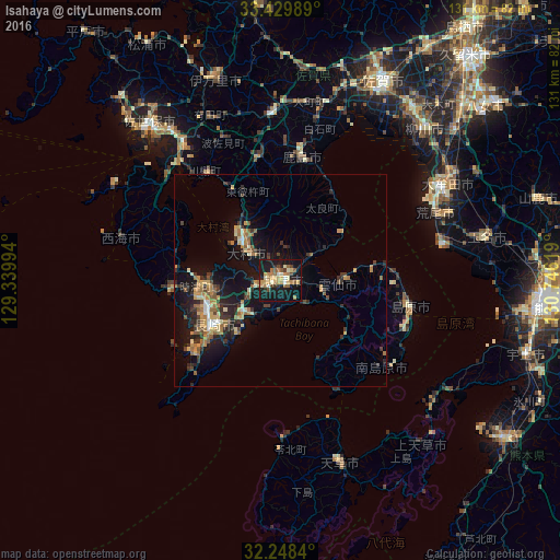
Analysis of Isahaya night lights 2016
Square area 10x10 km:
 1.22%
1.22%90-99
5.24%80-89
4.02%70-79
5.42%60-69
9.79%50-59
4.9%40-49
3.15%30-39
2.97%20-29
4.02%10-19
45.63%0-9
13.64%Square area 50x50 km:
0.35%90-99
0.76%80-89
1.09%70-79
1.45%60-69
1.94%50-59
1.29%40-49
0.83%30-39
1.74%20-29
2.55%10-19
8.39%0-9
79.62%Clear (daylight) street map image can be seen on geolist.org.
Map coordinates:
33° 25' 47.6" North, 129° 20' 23.8" East
32° 50' 28" North, 130° 2' 35" East
32° 14' 54.2" North, 130° 44' 46.3" East
Some cities around Isahaya sort by population:
• Nagasaki
18 km =11.2 mi,  235°
235°
• Ōmura
12.2 km =7.6 mi,  316°
316°
• Obita
15.2 km =9.4 mi,  259°
259°
• Shimabara
30.9 km =19.2 mi,  101°
101°
• Takeochō-takeo
38.9 km =24.2 mi,  356°
356°
• Kashima
29.8 km =18.5 mi,  8°
8°
• Togitsu
18.1 km =11.2 mi,  267°
267°
• Ureshinomachi-shimojuku
30.5 km =19 mi,  352°
352°
1861464 (p: 97,371)
Sources (retrieved 2019-11-25):
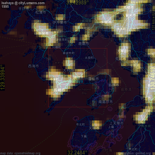
» NASA, Earths city lights 1995
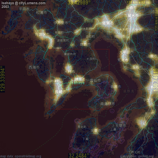
» NASA city lights 2003
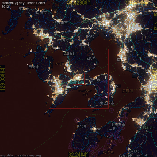
» Earth at Night: Flat Maps 2012, 2016