Rehab night lights from space
Night Light of Rehab (Mafraq) from space (Jordan) Src. Average luminocity for 10x10km area is 36.5403% and for 50x50km: 39.8482%.
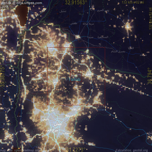
Analysis of Rehab night lights 2016
Square area 10x10 km:
 0.37%
0.37%90-99
2.01%80-89
5.13%70-79
5.31%60-69
3.66%50-59
6.23%40-49
15.57%30-39
13.55%20-29
16.67%10-19
31.32%0-9
0.18%Square area 50x50 km:
2.45%90-99
3.67%80-89
8.98%70-79
7.02%60-69
5.05%50-59
5.95%40-49
10.06%30-39
9.3%20-29
14.8%10-19
20.22%0-9
12.5%Clear (daylight) street map image can be seen on geolist.org.
Map coordinates:
32° 54' 56.3" North, 35° 23' 15.9" East
32° 19' 24.3" North, 36° 5' 27.1" East
31° 43' 38.3" North, 36° 47' 38.4" East
Some cities around Rehab sort by population:
• Mafraq
11.2 km =7 mi,  78°
78°
• Jarash
18.6 km =11.6 mi,  255°
255°
• Sūf
23.9 km =14.9 mi,  267°
267°
• Şakhrah
23.9 km =14.9 mi,  282°
282°
• Al Ḩamrā’
14.2 km =8.8 mi,  24°
24°
• Al Kittah
24 km =14.9 mi, 257°
• Kitim
22.3 km =13.9 mi,  305°
305°
• Balīlā
16.2 km =10.1 mi,  297°
297°
247336 (p: 10,000)
Sources (retrieved 2019-11-25):
» Earth at Night: Flat Maps 2012, 2016