Ventimiglia night lights from space
Night Light of Ventimiglia (Liguria) from space (Italy) Src. Average luminocity for 10x10km area is 34.8576% and for 50x50km: 10.0481%.
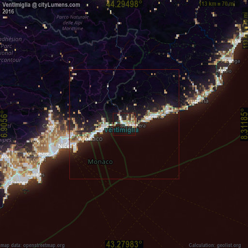
Analysis of Ventimiglia night lights 2016
Square area 10x10 km:
 3.94%
3.94%90-99
7.88%80-89
4.7%70-79
4.7%60-69
5.3%50-59
4.24%40-49
1.97%30-39
1.52%20-29
8.18%10-19
42.27%0-9
15.3%Square area 50x50 km:
1.33%90-99
1.9%80-89
0.86%70-79
1.15%60-69
1.52%50-59
1%40-49
1.14%30-39
0.8%20-29
3.1%10-19
11.1%0-9
76.1%Clear (daylight) street map image can be seen on geolist.org.
Map coordinates:
44° 17' 41.9" North, 6° 54' 20.2" East
43° 47' 22.4" North, 7° 36' 31.4" East
43° 16' 47.4" North, 8° 18' 42.7" East
Some cities around Ventimiglia sort by population:
• San Remo
13.9 km =8.6 mi,  77°
77°
• Menton, FR
8.5 km =5.3 mi,  260°
260°
• Monte-Carlo, MC
15.6 km =9.7 mi,  249°
249°
• Beausoleil, FR
15.8 km =9.8 mi, 250°
• La Condamine, MC
16.3 km =10.1 mi, 247°
• Roquebrune-Cap-Martin, FR
10.6 km =6.6 mi, 254°
• Bordighera
4.6 km =2.9 mi,  102°
102°
• Vallecrosia
2.5 km =1.6 mi, 97°
3164582 (p: 18,442)
Sources (retrieved 2019-11-25):
» Earth at Night: Flat Maps 2012, 2016