Bordighera night lights from space
Night Light of Bordighera (Liguria) from space (Italy) Src. Average luminocity for 10x10km area is 33.2318% and for 50x50km: 8.6634%.
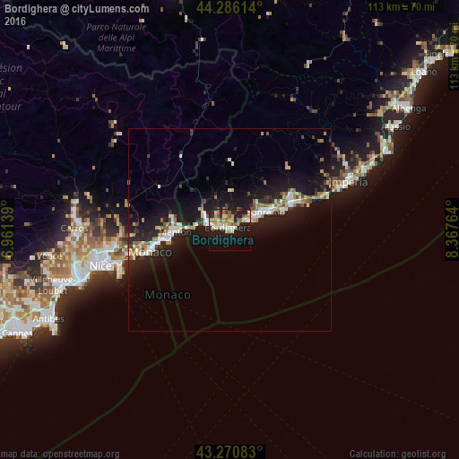
Analysis of Bordighera night lights 2016
Square area 10x10 km:
 3.33%
3.33%90-99
6.52%80-89
4.09%70-79
6.06%60-69
4.39%50-59
5.15%40-49
2.58%30-39
1.67%20-29
8.64%10-19
34.24%0-9
23.33%Square area 50x50 km:
0.99%90-99
1.6%80-89
0.72%70-79
0.88%60-69
1.35%50-59
0.85%40-49
0.91%30-39
0.72%20-29
2.6%10-19
11.15%0-9
78.22%Clear (daylight) street map image can be seen on geolist.org.
Map coordinates:
44° 17' 10.1" North, 6° 57' 41" East
43° 46' 50.3" North, 7° 39' 52.2" East
43° 16' 15" North, 8° 22' 3.5" East
Some cities around Bordighera sort by population:
• San Remo
9.9 km =6.2 mi,  65°
65°
• Menton, FR
12.9 km =8 mi,  267°
267°
• Ventimiglia
4.6 km =2.9 mi,  282°
282°
• Monte-Carlo, MC
19.6 km =12.2 mi,  256°
256°
• Beausoleil, FR
19.9 km =12.4 mi, 257°
• Taggia
16.7 km =10.4 mi,  64°
64°
• Roquebrune-Cap-Martin, FR
14.8 km =9.2 mi, 262°
• Vallecrosia
2.2 km =1.4 mi,  288°
288°
3181864 (p: 9,016)
Sources (retrieved 2019-11-25):
» Earth at Night: Flat Maps 2012, 2016